
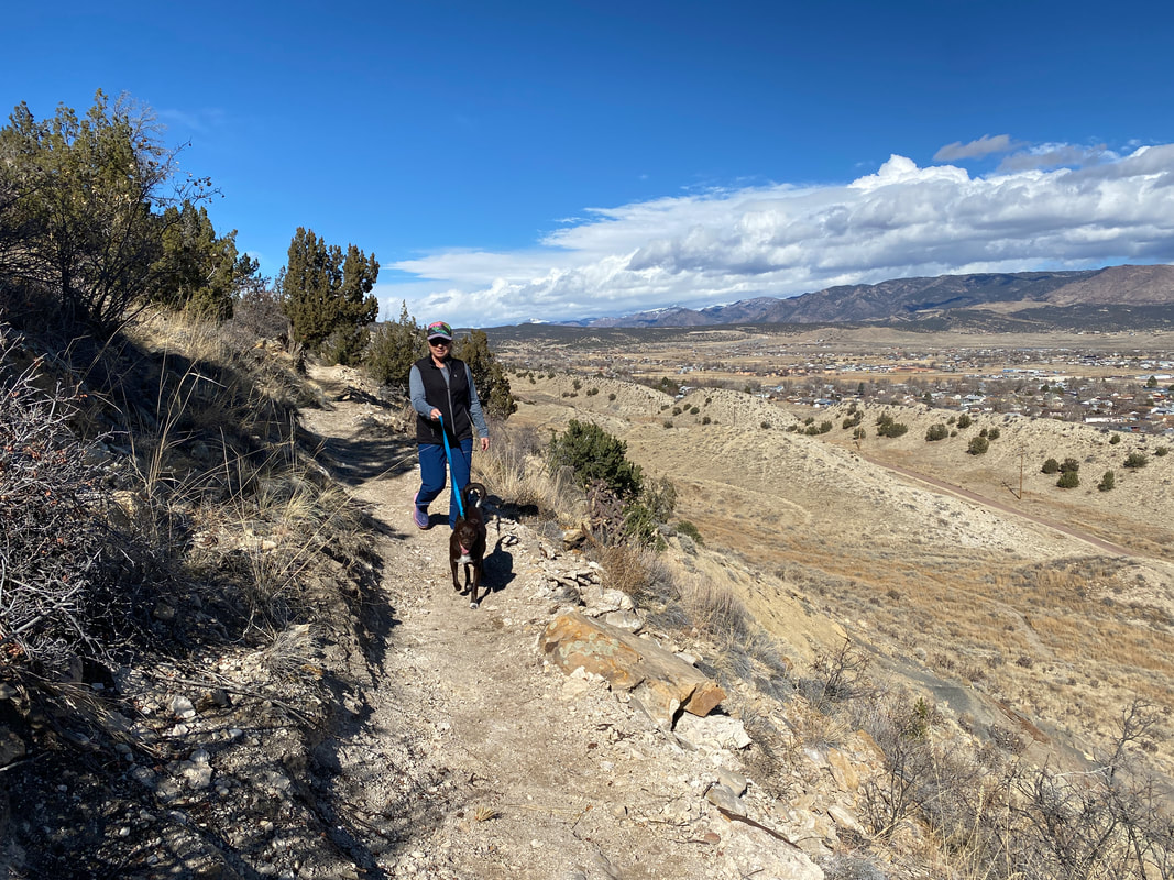
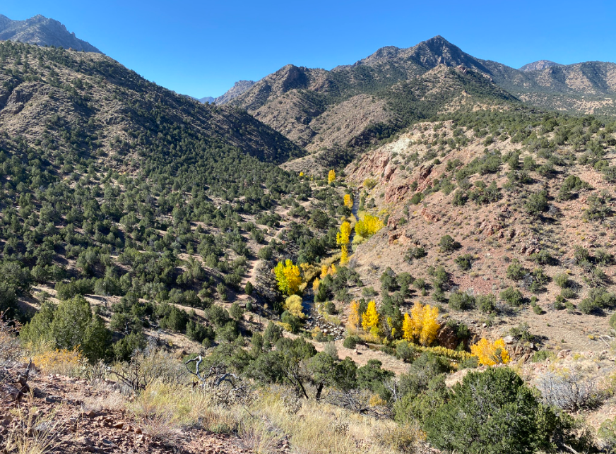
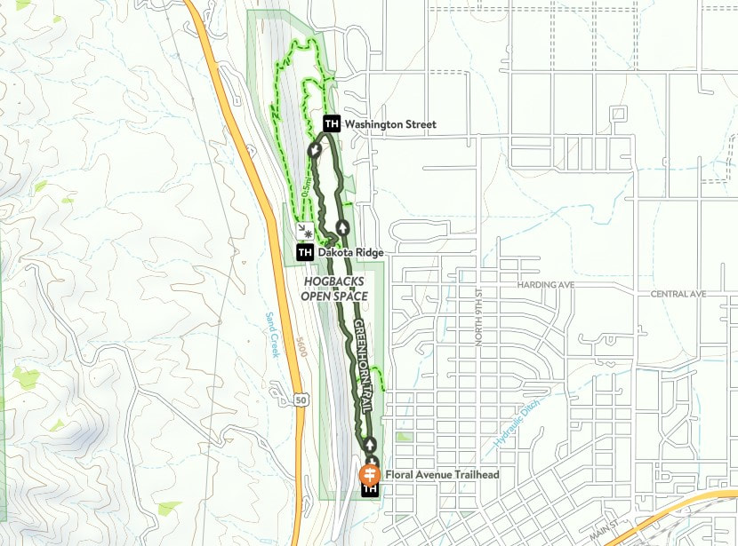
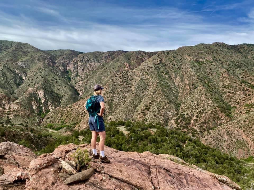
In 1905, the Cañon City Daily Record reported that a "much talked-of pleasure driveway along the top of the hogback is rapidly becoming a reality" (Daily Record, October 12, 1905). Thus began the Hogback's official journey toward rewarding recreational drivers, hikers, and mountain bikers with stunning views of the valley. These days, visitors to Skyline Drive and the Hogbacks can enjoy a white-knuckled drive over the top Skyline, or challenge themselves to several singletrack adventures on the east-facing side of the geological feature. The addition of a 1-mile extension of Stone Quarry - now open - facilitates a challenging and scenic loop along the middle of the largest hogback feature. Located parallel to and below Skyline Drive and above Graneros, the black-diamond (difficult) trail features great views, technical features, access to the historic quarry, and the ability to connect to other trails.
In the 1800's, the hogbacks was a hotbed of activity - from mining to quarries. Rock mined from the Hogbacks was used to build the Territorial Prison, located downhill from the site on Highway 50.
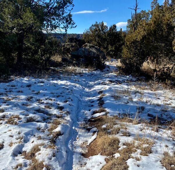
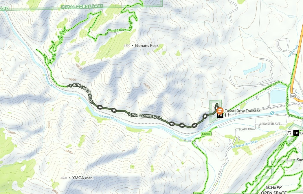
Many may have already hiked the Stone Quarry trail, which has an access point along Old Skyline Drive. Last summer's storms damaged a portion of the 100-year-old retaining wall near the trail's start, but this was repaired by the City. Access remains from Old Skyline Drive (about halfway up from the Washington Street trailhead), but the trail now continues from the site of the quarry to a juncture with Greenhorn near the Floral Avenue Trailhead.
Thanks to a mine shaft closure grant (from state mine royalty funding) initiated by FAR in 2020, the trail was completed in early February by trailbuilders Steve Thomas and Fremont Mitigation & Services (Kirk Anderson and Kerry Meier with assistance by local High School MTB Team rider Sage Currado).
About halfway along the trail, users will note a large steel grate - indicating a recently closed mine. Thanks to efforts by the Colorado Division of Reclamation, Mining, and Safety, the site is now sealed, but remains open to residents of the hillside - bats. (You're welcome to call the trail by it's unofficial nickname, a portmanteau of 'bat' and 'habitat' - "Batatat".) Please do NOT disturb the grate, as bats are an important part of our local ecology, assisting in pest control, pollinating plants, and dispersing seeds (U.S. Fish and Wildlife Service).
In the 1800's, the hogbacks was a hotbed of activity - from mining to quarries. Rock mined from the Hogbacks was used to build the Territorial Prison, located downhill from the site on Highway 50.
Many may have already hiked the Stone Quarry trail, which has an access point along Old Skyline Drive. Last summer's storms damaged a portion of the 100-year-old retaining wall near the trail's start, but this was repaired by the City. Access remains from Old Skyline Drive (about halfway up from the Washington Street trailhead), but the trail now continues from the site of the quarry to a juncture with Greenhorn near the Floral Avenue Trailhead.
Thanks to a mine shaft closure grant (from state mine royalty funding) initiated by FAR in 2020, the trail was completed in early February by trailbuilders Steve Thomas and Fremont Mitigation & Services (Kirk Anderson and Kerry Meier with assistance by local High School MTB Team rider Sage Currado).
About halfway along the trail, users will note a large steel grate - indicating a recently closed mine. Thanks to efforts by the Colorado Division of Reclamation, Mining, and Safety, the site is now sealed, but remains open to residents of the hillside - bats. (You're welcome to call the trail by it's unofficial nickname, a portmanteau of 'bat' and 'habitat' - "Batatat".) Please do NOT disturb the grate, as bats are an important part of our local ecology, assisting in pest control, pollinating plants, and dispersing seeds (U.S. Fish and Wildlife Service).
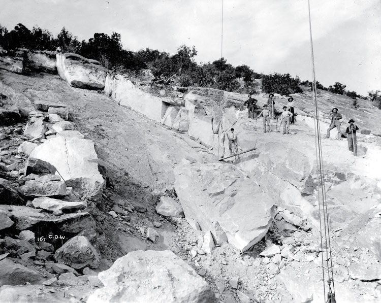
Workers at the Harding Sandstone Quarry, just north of the Hogbacks, in 1890. Photo Courtesy of the U.S. Geological Society.
Stone Quarry is part of the Eastern Fremont Trails Trails and Open Space Master Plan, which stipulates the need for a looped trail throughout the Hogbacks. The trail system is integrated into the Royal Loop plan, which FAR has continually been working toward and creates access via singletrack from town to the Royal Gorge Park and back. FAR was part of the master plan process in 2012. This project was funded by FAR's 1% for Trails Community Initiative and was supported by the City of Cañon City, which provided additional construction funding, staff, and equipment. FAR is dedicated to the maintenance of the trail, in addition to other trails in the Hogbacks system.
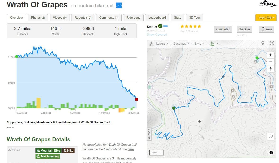
Trail Beta
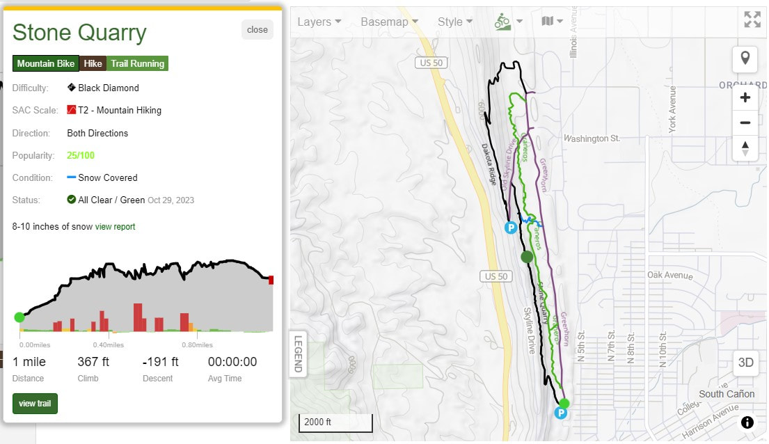
Trail Name: Stone Quarry
Distance: 1.1 miles
Level: Difficult (Black Diamond)
Surface: Natural Surface Singletrack
Map: Available on Trailforks (will be available on others, including Cotrex, soon)
Features: Some technical points, steep switchback, closed mine shaft (do not throw rocks, please be kind to bat habitat)
Trail Beta
Trail Name: Stone Quarry
Distance: 1.1 miles
Level: Difficult (Black Diamond)
Surface: Natural Surface Singletrack
Map: Available on Trailforks (will be available on others, including Cotrex, soon)
Features: Some technical points, steep switchback, closed mine shaft (do not throw rocks, please be kind to bat habitat)
More information about Stone Quarry trail can be found on Trailforks.
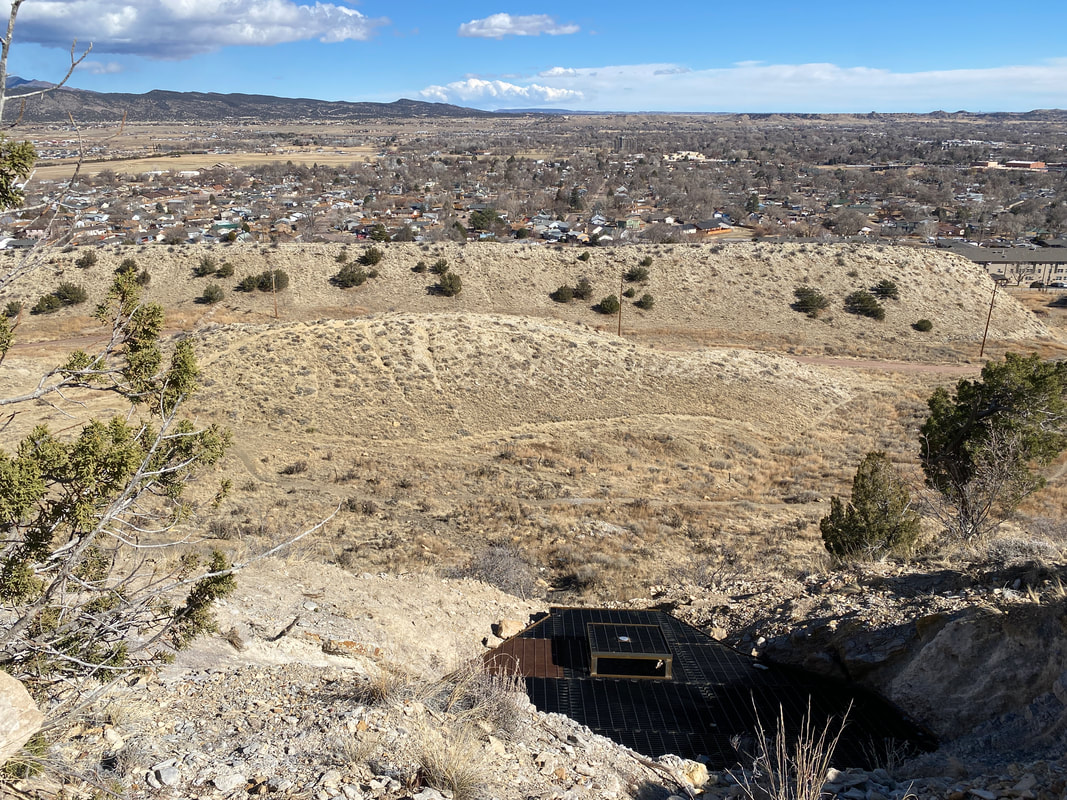
A recently closed mine is visible from the Stone Quarry Trail (aka Batatat) overlooking the City of Cañon City. The mine was officially closed by the Colorado Division of Reclamation, Mining, and Safety.
 RSS Feed
