
Royal Adventures - Hiking, Running, Biking
|
|
Need maps? Download a FREE Adventure guide. Or, use the COTrex app to help you navigate the trails in our area. Maps are updated regularly and will even track you as you explore. You can even plan your own routes!
|
If you're a hiker or runner who loves incredible scenic vistas, challenging terrain, easy accesss to trailheads, and everything else that the great outdoors provides, Cañon City is a trail-user's mecca. The Royal Gorge Region offers over 62 miles of singletrack trail on public lands and open spaces. All of the trails are FREE to use. Find a trail, practice Leave No Trace principles, and have some fun!
BEginner route suggestions
|
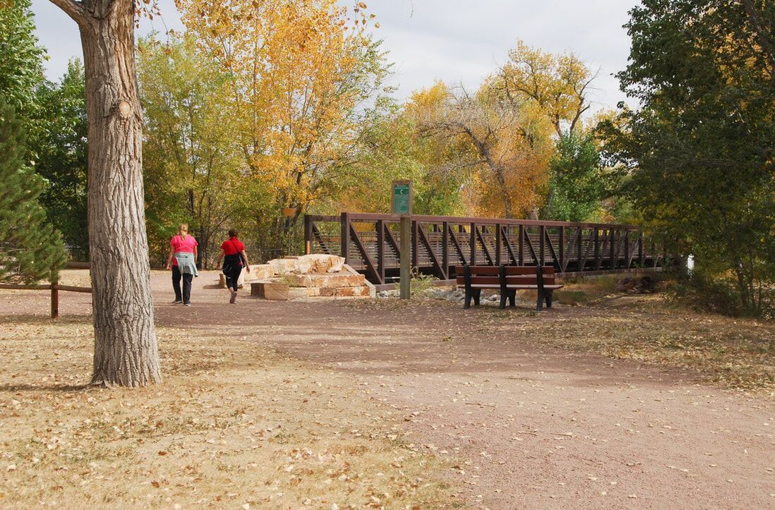
Riverwalk
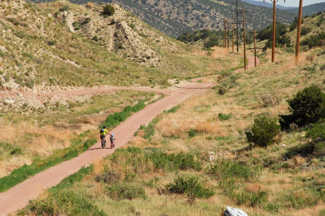
System: Riverwalk Distance: 1-14 miles This gorgeous, 7-mile stretch of wide, gravel trail will give you plenty of time to clear your head and enjoy the views of the Arkansas River. Start at Centennial Park, the Sells Avenue Trailhead, or Makenzie Avenue (though be aware that the stretch from Makenzie to Reynolds is a bit more remote). Except for Reynolds hill (about halfway), it's a pretty flat, easy walk or ride. |
|
Old Skyline Drive
System: Hogbacks Open Space Distance: 1 mile CoTrex Route: https://trails.colorado.gov/routes/85509 Park at the Washington Avenue trailhead and head up Old Skyline Drive. This is a wide, smooth path, but it does have about 255 feet of elevation gain (about 20 stories tall). From here, you can continue on to Dakota Ridge (turn R at the top and head up), but be aware that there are steep dropoffs and the trail is natural suface with plenty of uneven and rocky areas. |
|
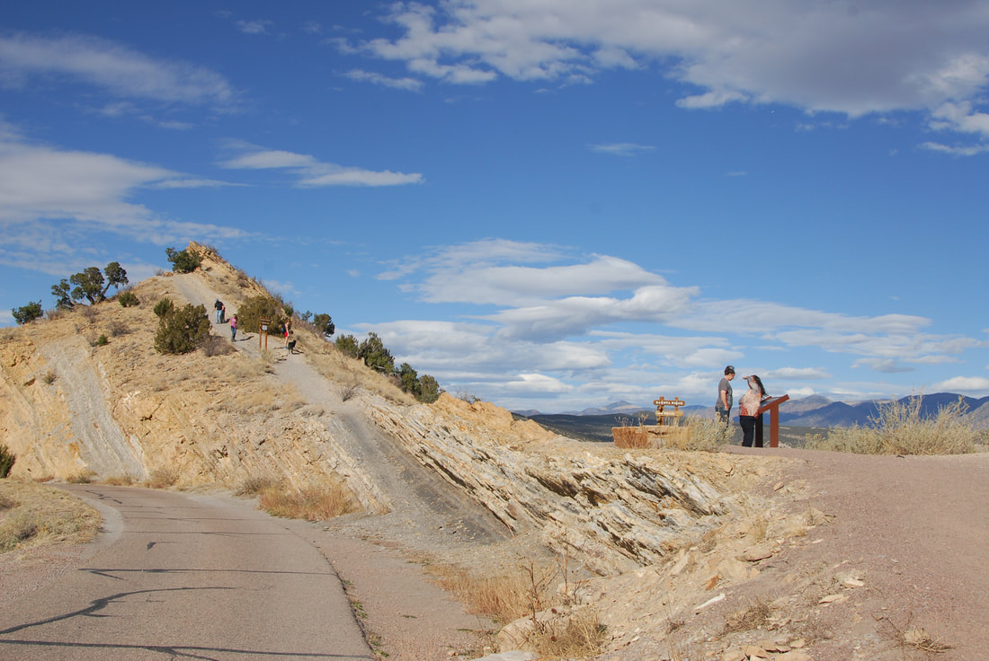
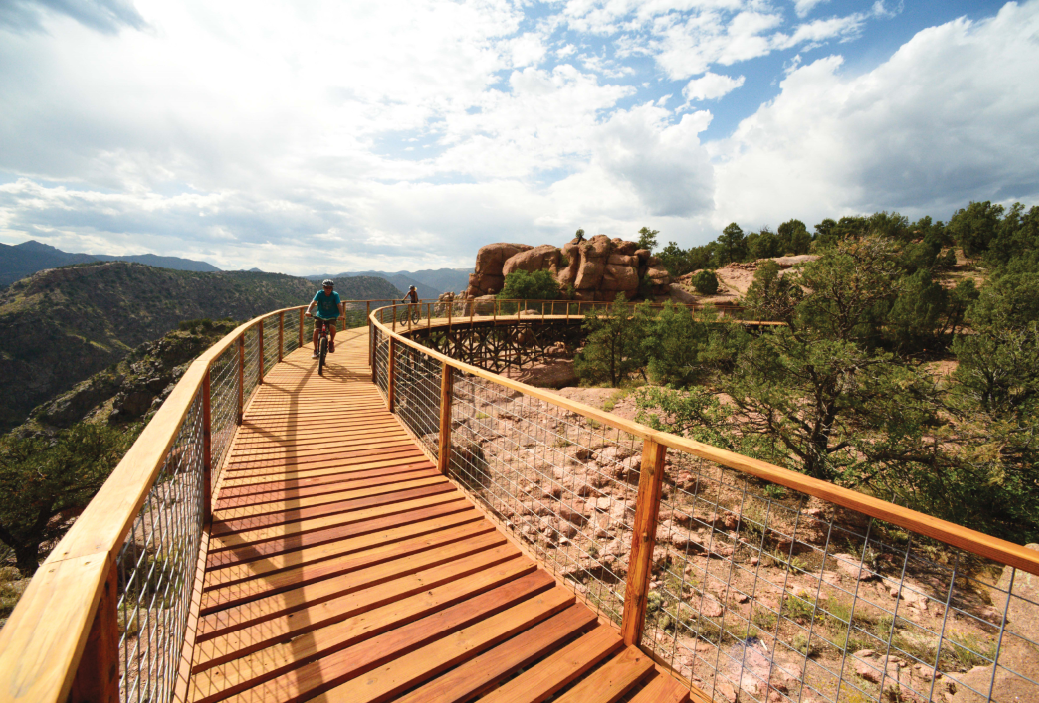
Point Alta Vista
System: Royal Gorge Trails Distance: 2.4 miles CoTrex Route: https://trails.colorado.gov/routes/85507 Check out the historic trestles at Point Alta Vista, which used to be a mini-train route. This is a wide trail with just a little bit of elevation gain that is suitable for families and kids. Be aware there are no restrooms at the trailhead or the viewpoint. |
|
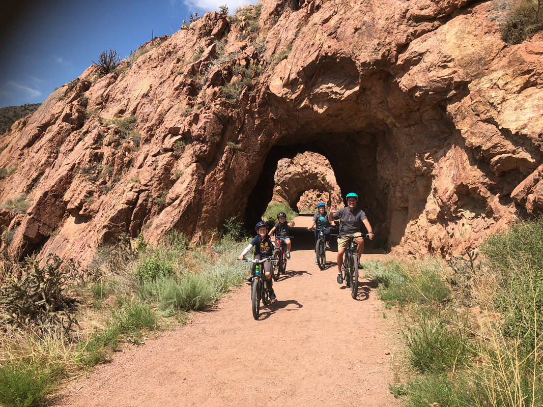
Tunnel Drive
System: Rivewalk Distance: 1-4 miles CoTrex Route: https://trails.colorado.gov/routes/85498 At the western-most end of the Riverwalk, Tunnel Drive has its own trailhead and parking area. Overcome the steep hill at the begining and it's just .25 miles to the Tunnels and 2 more miles of flat, beautiful trail to the end. This is an out-and-back only. |
Intermediate And Advanced route suggestions
|
Greenhorn to Graneros
System: Hogbacks Open Space CoTrex Route: https://trails.colorado.gov/routes/85508 This is a great trail system to get into trail running or mountain biking. Try running Greenhorn for some warm-up hills, Graneros for some flowy singlegrack with just a little bit of exposure (drop-offs on the side of the trail) and a few small rocks. Challenge yourself to climb Old Skyline Drive if you're training or want a great view of the City. |
|
Dakota Ridge
System: Hogbacks Open Space CoTrex Route: Start at Floral Avenue Trailhead and head out on Greenhorn for an easy warm-up. When you reach the juncture for Old Skyline, earn some great views by heading straight up. Dakota Ridge has significant exposure and is very technical, so proceed according to your ability level. Descend and take Graneros back for singletrack fun. |
|
Lower South Cañon Loop
System: South Cañon Trails Distance: 5 miles CoTrex Route: https://trails.colorado.gov/routes/85505 The singletrack is a little more even here, but you can find plenty of elevation gain and views to keep your head happy. Start at the Eagle Wing Traihead and head up Schepp Ridge for a great warmup, then head out on Recycle (flowy and fun!) to Mutton Bustin'. Great for intermediate runners and riders. Great views from Schepp Ridge! |
|
Temple Canyon to Great Escape
System: South Cañon Trails Distance: 10.2 miles with options to add CoTrex Route: https://trails.colorado.gov/routes/85516 Climb some great "warmup" trails before hopping on Temple Canyon Road and climbing up to the Great Escape trailhead. Add the Watchtower loop in for more mileage and great views of Grape Creek. Or, descend down Great Escape to Hard Time and on to Mutton Bustin' to finish your ride with flowy fun. |
|
Watchtower / Wrath of Grapes
System: South Canyon / Temple Canyon Park Distance: 11 miles with option to add CoTrex Route: https://trails.colorado.gov/routes/117110 Park at the Great Escape trailhead for a shorter ride (or lower parking lots to add significant mileage) and head out on Watchtower. Get views of Grape Creek and the Sangres, plus plenty of fun singletrack. The trail crosses the road two times, so be aware. Descend Wrath for great fun, then climb back out the same way or take the road back. |

|
Overlook Loop
System: Royal Gorge Trails Distance: 1.5 miles CoTrex Route: https://trails.colorado.gov/routes/85495 Looking for some rockier terrain and some grand views? Start at the Canyon Rim Trailhead on CR3A (bathrooms and pavilions), cross the road, and take a R at the Y to head out on the Overlook Loop trail. You'll see the Sangre de Cristo Mountains, the Royal Gorge, Arkansas River, and so much more. Great sunset hike! |
|
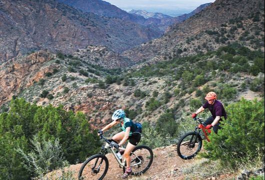
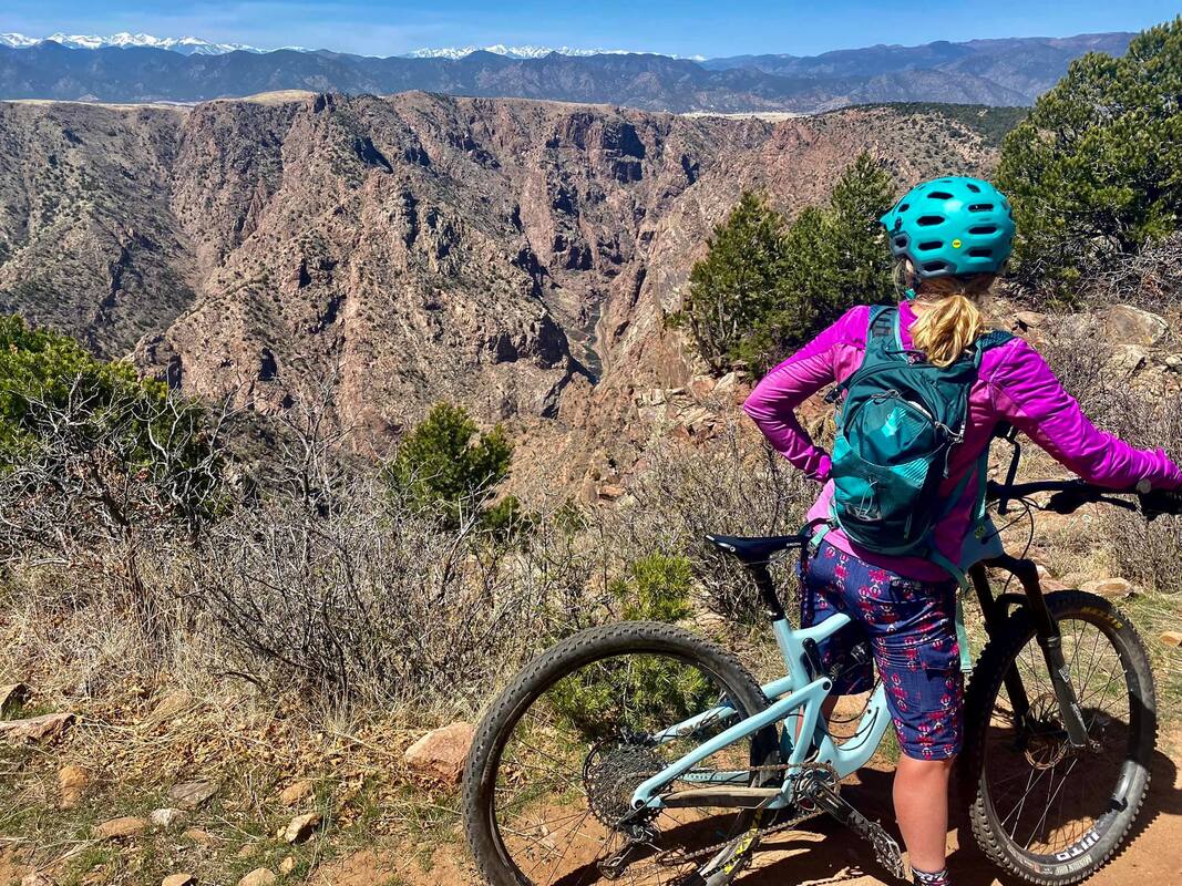
Royal Gorge Trails Loop
System: Royal Gorge Trails Distance: 10 miles CoTrex Route: https://trails.colorado.gov/routes/85512 This is a great introduction to the Royal Gorge Trails System. Hit fan favorites like The Maze (great climb), FAR Out, Canyon Rim, and the flowy Twisted Cistern before adding on Made in the Shade. For additional mileage, add Summit view to the eastern portion of the route, or add the uber-challenging One Track Mind (though you have to come back that way or ride CR3A back to your vehicle). |
|
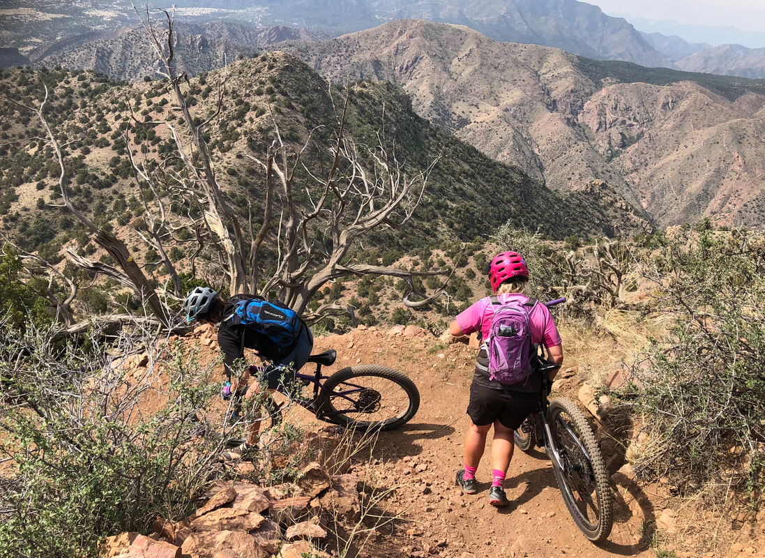
One Track Mind to Point Alta Vista
System: Royal Gorge Trails Distance: 6.7 miles CoTrex Route: https://trails.colorado.gov/routes/116950 This super loop will take you from the Made in the Shade Trailhead to one of the most iconic views in the region - Point Alta Vista. One Track Mind is a technical and sometimes steep trail with glorious views of the Gorge and the mountains. Most people prefer to only ride it one-way and ride the road back to the trailhead. |
|
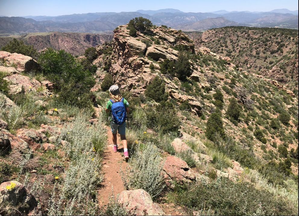
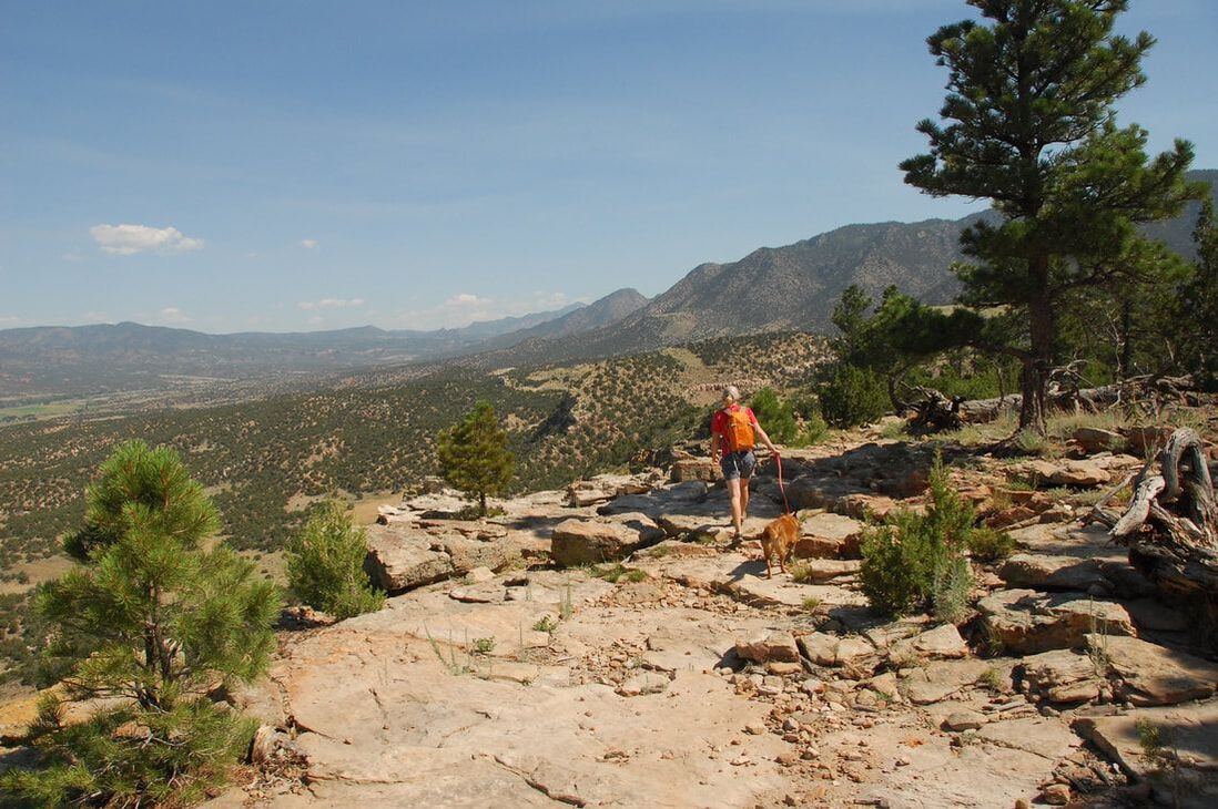
Fremont Peak Summit
System: Royal Gorge Trails Distance: ~4.75 miles CoTrex Route: https://trails.colorado.gov/routes/116637 Summit the iconic Fremont Peak in just a few miles! Start at the campground and head out on singletrack for a 4.5 mile out-and-back or loop on some of the Royal Gorge Trails' best offerings. A new trail at the summit makes climbing to the top easier than ever before, perfect for trail runners and hikers (bikes not recommended). |
|
Royal Cascade
System: Royal Gorge Trails Distance: at LEAST 7.5 miles ONE WAY (shuttle suggested) CoTrex Route: https://trails.colorado.gov/routes/85511 Be aware that this is a double-black diamond trail. It is best enjoyed by hikers going up or down, but is best enjoyed by mountain bikers going DOWN only. Descend with care and caution! This trail is a connector, meaning it doesn't have it's own trailhead, and you have to add at least 1.5 miles on each end just to get to it. The views, however, are incredible and the workout is worth it. |
|
Fire Canyon, Island in the Sky
System: Oil Well Flats Distance: 5.5 miles CoTrex Route: https://trails.colorado.gov/routes/85510 You can find big elevation gain and lots of technical rock-hopping on this trail system outside of Cañon City. Run or ride from the Fire Canyon Parking lot (may require a sturdy, high-clearance vehicle) to Fire Canyon, then up the backside of Island in the Sky to achieve a great view...and descend the harder, rockier terrain. To add mileage, mountain bikers can add lower trails or MOOve Over. |
|
Unconformity Loop
System: Oil Well Flats Distance: CoTrex Route: However you reach it, Unconformity is a great run or ride and has a wealth of scenery. Try this loop to hit some of the best trails in the Oil Well Flats trail system and end on a great downhill trail - MooVe Over. |
