Trail Info
Fremont County is home to some of the most beautiful public land spaces in Colorado. From the Royal Gorge to Red Canyon Park, this area boasts scenic vistas at every turn.
There are four main trail systems in the area that offer 12+ miles of trail each. These include, the Hogbacks Open Space and Recreation Area, the Royal Gorge Trails, South Cañon Trails, and Oil Well Flats. You can find information on each of these trail systems by clicking on the button below and visiting the page dedicated to them. Each system has trails that are rated from green (beginner) to black (advanced), and offer a variety of adventures. Please be sure to pack and plan appropriately and only hike / ride / run according to your individual skill level.
If you're in need of a map, stop by the Royal Gorge Chamber Alliance's downtown location and pick up one of our handy Adventure Guides. Or download it here.
using trails
|
It's always a good idea to have a plan when heading out on trails. Especially in the winter, weather conditions can hinder your weekend or hiking / riding plans. If there's been snow within the last few days, odds are that trails are muddy and should not be used. (This creates long-standing damage that can make "potholes" or deep ruts in the trail that hold water and make drying out difficult.)
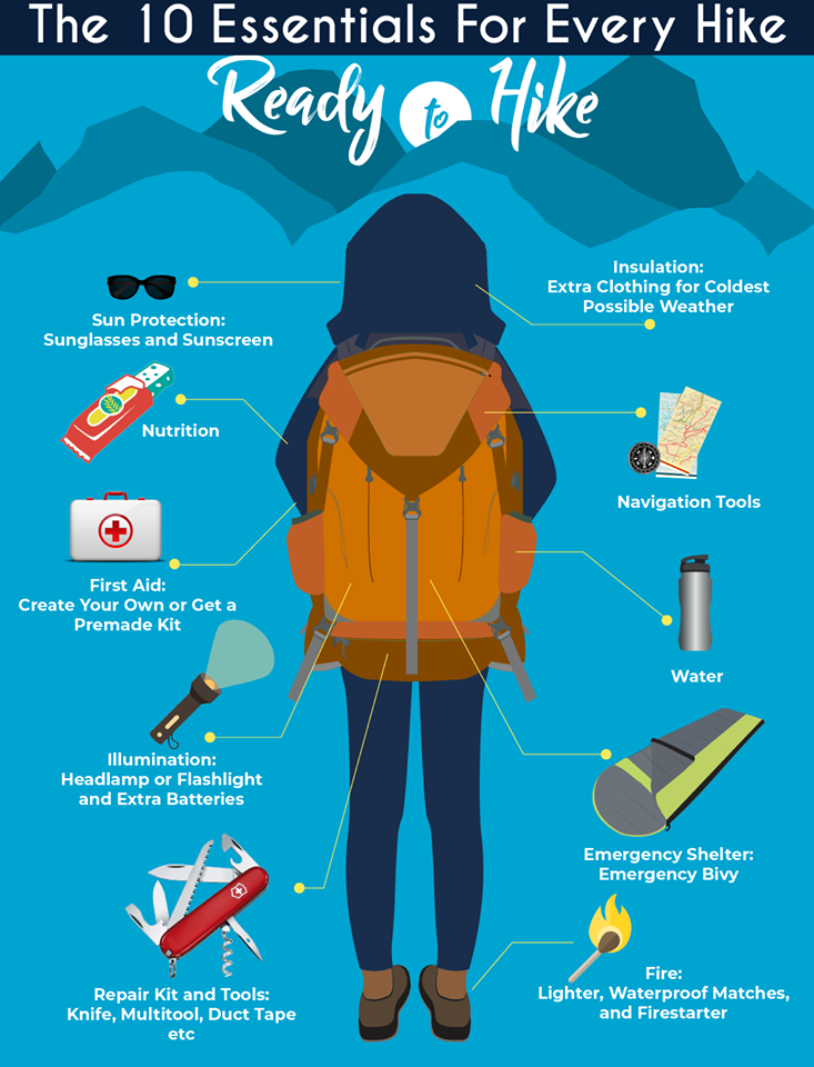
Remember to bring the 10 essentials with you:
|
|
Unsure of where you're headed? There are plenty of apps that will help track you as you continue on your adventure. Colorado Parks and Wildlife has developed a free app - CoTrex - that lists and updates all of the trails in Colorado. Download it and you can check out local (plus state-wide) maps of trails for a variety of uses. (Newer trails may not be included as updates are done on a quarterly basis.)
Please always be sure to stay the trail, for your safety, the consideration of wildlife, and for erosion control. Care for Colorado and Leave No Trace! |


