Fremont Adventure Recreation
  • Home
  • AdventureGuide
  • Trail Info
    • Trail Conditions
    • Royal Gorge Region Trails
    • Royal Gorge Trails
    • South Canon Trails
    • Oil Well Flats
    • Trail Love
  • News
    • Blog
    • Land Use Issues
  • Events
    • runBlossom 2025 >
      • Y.E.T.I. 2025
    • Tunnel Vision
    • Resolution Run
    • runBlossom >
      • Y.E.T.I.
    • Dino-Rific 1Mi Kids' Run
    • Women's Mountain Bike Sesh
    • Snow Queen Event
    • RunFAR Run Club
  • Activities
    • Visiting Cañon City
    • Family Adventures
    • Hiking / Trail Running
    • Mountain Biking
    • Camping
  • Who We Are
    • Our Board
    • Community Outreach
  • Support / Contact
    • 1% for Trails
    • Sponsors

Riverwalk bike playground

2/8/2025

0 Comments

 
Location: Old ropes course, near Sells Avenue Trailhead
Area: ~ 2 acres
Existing structures: Pavilion, restrooms
Total Cost: About $20,000
Timeline: Spring 2025 completion
Contractors: American Bike Ramps, volunteer labor, Terra Firma Trails

We love supporting all levels or mountain bike riders in our community and are excited to be able to offer a new park experience by building a beginner play / skills area. In conjunction with the Canon City Area Recreation and Parks District (who manages the land), the Great Escape Trail Events and FAR are working toward opening the Riverwalk Bike Playground in spring of 2025.

The park is designed for BEGINNERS and LEARNERS. There will be no features over 18” off the ground so that it is a low-stakes environment for young and developing riders.

This area is close to: the Sells Avenue Parking lot, maintenance access on the Riverwalk, existing restrooms. It is easily accessible from the Riverwalk trail from either end of town. All features will be designed to “blend into” the park and appear as natural as possible. 

Here's what our community decided to add to the park: 
  • Snake Ladder
  • Split Decision
  • Podium Box
  • Double Roller
  • Teeter Totter

Important Note: This location is considered “temporary”. This is a need in our community that we’d like to fill immediately, and when the property may be called up on for a water project in 5-10 years, the features will need to be moved. At that time, we'll find an appropriate new home for the features and they will NOT BE disposed of. 

Picture

FAQ's

Why not just build natural features?
We absolutely will! We’ll plan to use natural surfaces and natural materials for a few of the features, to include some rocks to climb up and some logs for “skinnies”. 


Will this only be for kids? 
While we will design the playground to be a place for young learners to practice, this park will be open to learners of ALL ages. Many new mountain bikers enjoy a low-stakes environment in which to practice skills like technical ascent, balance, etc. 

Will there be a big hill for acceleration like at other parks? 
No. There will be no big elevation changes since we will be working with the natural topography of the landscape. There will be some berms to help teach / learn body positioning, but there won’t be a big hill to facilitate a large acceleration point. 

Why so expensive? 
The features that we’d like to place at the playground are professionally designed and built to encourage safety. We’ll buy as many features as we can afford! Right now we have secured about $17,000 through proceeds from the Great Escape Trail events ($13,000) and a donor ($5,000).  
​
0 Comments

Royal Loop gravel Ride

12/5/2024

2 Comments

 
The Royal Gorge Region is home to a wealth of recreational opportunities, including several scenic and challenging gravel / singletrack cycling routes. Thanks to a coordinated partnership with the City of Cañon City, The Royal Gorge Bridge & Park, and Fremont Adventure Recreation, the community is excited to announce yet another unique opportunity for cyclists – the Royal Loop Gravel Ride. This world-class route incorporates both gravel and singletrack to create a 30-mile loop beginning and ending in Cañon City. Cyclists can start at the South Cañon trail system, utilize a mix of trails and gravel road to approach the Royal Gorge Bridge & Park from the south, present a pass to enter the park, ride over the Royal Gorge Bridge, then return to town via trails or paved roads.
​
Please follow all rules pertinent to entering the Park:
  1. Purchase a ticket to enter the Royal Gorge Bridge & Park. You can either purchase a day pass ahead of time online for $29, have your season pass with you, or enter with a friend who has a family season pass. This is NOT OPTIONAL. Failure to purchase or carry a pass may result in fines and prosecution.
  2. Observe all posted speed limits.
  3. Be EXTRA courteous to all pedestrians on the bridge and in the park boundaries. Pedestrians have the right-of-way at all times.
  4. Show your pass to any rangers and also stop into the Visitor’s Center so they can scan your pass.
  5. Parking on the south side (CR3A) is not permitted. 
  6. Observe all road cycling rules: https://www.bicyclecolorado.org/ride-colorado/rules-of-the-road/
  7. Runners or other pedestrians are NOT allowed to enter the bridge on the South rim due to logistical and safety concerns. Trespassers will be fined. 
We are incredibly grateful to the City of Cañon City and also the Royal Gorge Bridge & Park for allowing cyclists to access the bridge and trail system in this way. Each cyclist should act accordingly and adhere to all appropriate rules and etiquette. This is a privilege that will only be extended if the overall experience for bridge management, park visitors, and cyclists is positive.

This route is challenging – with over 4,272 feet of elevation gain - and access to the bridge should only be attempted as part of a longer ride. NO additional parking is offered on the south side of the City’s Royal Gorge Park.
​
Cyclists are strongly encouraged to purchase a season pass – available in April to all Colorado residents – that will allow year-round access to the Bridge. Daily admission is $29 per adult if purchased online.

2 Comments

Student Adventure Guide Art Contest

10/21/2024

0 Comments


We need a new back cover for our 2025 Student Adventure Guide! This guide is printed and distributed to over 300 local students each year. One winner will have their art printed on the back cover for our newest edition - it could be you! 
​
​Instructions: 

1. Create a work of art that describes what you love about being in the outdoors in Fremont County. 
2. You can use any medium, including colored pencil, marker, collage, etc. 
3. Return scanned entries to [email protected] or to The Hive (729 Main Street, Cañon City). 

Rules: 

1. This contest is open to all youth ages 3-18 who live in Fremont County.
2. Entries are due on Wednesday, November 13, 2024. 
3. Winner will be notified by November 20. 
4. Entries should be drawn, colored, and created by the entrant only. NO additional assistance should be given. 
5. Parents must give their permission on the entry form. 

Tips: 

1. Entries with less “white space” will score high.
2. Entries may use this 
paper or another paper. Final size will be 8.25 x 5.25”. 

Prizes:
 
1st - Your art on the back cover, $25 prize, a FREE entry to a FAR event, water bottle
2nd - $10, a FREE entry to a FAR event, water bottle
3rd - FAR water bottle 

See previous winners listed below: 
Entry Form
Picture
Picture
0 Comments

FAR is Fourteen!

10/16/2024

0 Comments

 
This year, we're celebrating our 14th birthday. Since 2010, we've been proud to be a part of our community - growing, discovering, promoting, and pursuing recreation opportunities for residents and visitors. As we have navigated challenges (like a global pandemic, rising costs of operation, and others), we remain committed to our mission: to promote a culture of community and healthy living through human-powered outdoor recreation in the Royal Gorge Region. 

When FAR began, just one running event and a social graced the yearly calendar, and since then, we've expanded our yearly offerings to include over half a dozen athletic competitions, various social meetups, numerous community events, and a great deal of community work. Some events have come and gone, but we've always tried to bring new and interesting events to runners, joggers, and mountain bikers. 

With only one part-time employee, board members with ever-demanding lives, generous and sponsors / members, and volunteers who have the biggest hearts in Colorado, we are constantly humbled by what this community can achieve. From only a few ragged miles of social and hiking trail, we've added 62 miles of singletrack to the map. We've grown runBlossom from a few downtown runners to one of the biggest events in Southern Colorado. Since 2015, Adventure Guides have helped countless people to find a new trail to explore and enjoy. We've helped our community to join larger conversations around Tourism Stewardship, Sesquicentennial Celebrations, public land management, and the future of outdoor recreation. We instituted an optional 1% trail donation program that's funded miles of singletrack in the area. It's work we've been honored to help with. 

In 14 years, we've also seen our community embrace the culture of outdoor recreation. As children growing up in the area are exposed to recreation opportunities, we've seen participation in running, mountain biking, river surfing, and climbing increase. Our local mountain bike team now boasts 20 participants - more than many communities our size. YOUR investment in creating a positive environment for recreation participation, paired with opportunities for children to be welcomed into recreation, is making a difference. It's not uncommon to see a former YETI runner now heading off to collegiate cross country meets. Kids who grow up riding Mutton Bustin' are now winning regional mountain bike accolades. It takes a village of recreation supporters to provide the infrastructure to make this possible. 


Picture

One a personal level, our board has grown in the last decade and a half, too. Several members of the board have been with the organization for over a decade, and since then, they've added children to their lives, moved, changed jobs, and generally "grown up". Events often take on a  new meaning as the next generation of FAR volunteers run events, win awards, assist with volunteer jobs, and become part of our work at FAR. Our kids have been handing out water, setting up cones, and riding along to meetings for a long time. 

We are so proud to share FAR with our community. Thank YOU for helping us to make it to 14 years of fun. We can't wait to see what the future holds. 

Thank you to our past and current board members for dedicating so much to FAR: 
​
Current members: 
Brian VanIwarden
Adam Hartman
Brian LeDoux
Joan Sindler
Megan Merry
Sean Weatherill
Jon Banker
Vicki Meier
Travis Payne

Former board members: 
Joanna McIntyre
Chris McIntyre
Thom LeDoux
Scott Eckstrom
Leticia Buswell


Our History


On October 10, 2010, three friends - Brian VanIwarden, Joanna McIntyre, and Chris McIntyre,  came together in a leap of faith and formed Fremont Adventure Recreation. Between them, they had a shared passion for outdoor recreation and a plethora of other talents - race directing, internet communication, coaching, and event organization. Their first task was to assist with the burgeoning runBlossom races, which was gaining traction in its third year and needed to evolve. To assist in this endeavor, they needed money. Timing software, technical equipment, and course materials weren't cheap. 

The board approached their first sponsor, The Winery at Holy Cross Abbey, with the hopes of acquiring the funds to get FAR off the ground. It was Larry Oddo who launched the organization with their first donation, making it possible for FAR to buy the generator that would power the timing equipment necessary for runBlossom. The board President's own mom, Shirley, even pitched in to buy FAR's first trailer, which you see today at races across the county. 

Little by little, hard-earned money began stacking up in FAR's account, and they were able to add events to their calendar. They also welcomed new board members, each who brought invaluable talents to the small group. As their budget and capacity grew, they added new events. This included Bikes & Brews, their first truly independent event,  in 2012. The annual runBlossom race now welcomes over 500 runners to Cañon City each year, and features the city's only half-marathon race. They time for the spectacular Rim to Rim every year, assist with the Whitewater Festival, and have added smaller events, such as movie nights, socials, kids and ladies' mountain bike clinics, and a scholarship program to their list of community contributions. 

As outdoor recreation continued to grow in the Royal Gorge Region, FAR gradually recognized a need for quality trail systems in addition to events. Partnering with the BLM, Recreation District, and the City of Cañon City, FAR worked to raise funds (including putting forth money from races as well as hiring a grant writer) to identify, design, and develop additional trails in the area. It was the introduction of the '1% for Trails' initiative in 2015, however, which helped to launch FAR into the business of building significant, extensive, world-class trail systems. Putting their trust and faith in the organization, Whitewater Bar & Grill and Red Canyon Cycles were the first to sign on to the program and invest in the future of Cañon City. Today, the Hogbacks, the Royal Gorge Trail System, South Cañon Trails, and additional work in Oil Well Flats bear the mark of those first businesses, board members, and Mcleod-wielding volunteers who made them possible. As additional businesses sign on, FAR is looking forward to helping the Royal Gorge Region community to expand their hiking, biking, and riding miles. 

It's been 14 years, one hundred and fifty-two board meetings, hundreds of hours at local events, several changes of tires on the trailer, and  thousands of happy runners / bikers. As with any organization, there have been changes, tense moments, disappointments, and setbacks. Not every decision has been easy, and not every opportunity has been met with success. But if you smile when you ride the Cañon Rim Trail, if you enjoy a quiet stroll with your dog on in South Cañon, or if you high-five someone in a FAR t-shirt at the finish line of a local race...you'll know why they do what they do. Because they love it, too.

Thank you, Cañon City, for your faith in our organization, your many selfless volunteer hours, your contributions to our fundraising efforts, your patronage of the businesses who support us, and for your encouraging compliments. We hope to serve you for decades to come. ​
Picture
Some of these little FAR adventurers are in high school! Where has the time gone? 
0 Comments

Why Support FAR as a Member or Sponsor?

4/26/2024

0 Comments

 
What happens to your donation when you give to FAR? Your donations help supplement our event income, which comes from putting on events throughout the year. These include: 
- Resolution Run
- Snow Queen Frosty February 5K
- runBlossom
- Dino 1-Mile Kids' Fun Run
- Great Escape Trail Events
- Tunnel Vision Duathlon

While we try to keep costs low (as part of our mission to get people outdoors and involved in community events), we also try to make a little money on each event so that it can pay for itself and help fund our other activities. 

You can read all about our financial information in our annual report, but here's the story on how we use funding: 

Community Outreach: 
We use funding to buy things like giveaways, swag, and educational material. We attend about 6-10 community events each year and constantly need to refresh our handouts and swag. We attend events such as: Penrose Elementary School STEAM Fair, Safety Jam, Earth Day at the  Royal Gorge Bridge, Royal Gorge Whitewater Festival, and in-class education sessions at local schools. 

Coordinator: 
We have one part-time employee - Ashlee - and we do pay her. She's our administrative assistant, event coordinator, event timer, graphic designer, marketing manager, community outreach coordinator, membership coordinator, educational outreach individual, sponsor communicator, and anything else we can think of. Many of you have met and worked with Ashlee, and know that she loves being part of FAR and our community. 

Scholarships and CCHS MTB Funds: 
We are proud to give four scholarships a year to local students who have volunteered their time to FAR throughout the years. Now that FAR is 14 years old, we have applications from students who have volunteered since they were very small! We also donate to local boosters and the Cañon City High School Mountain Bike Team to help provide travel costs and equipment for this lifetime sport. 

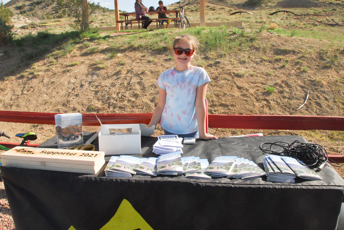
Adventure Guide / Maps: 
We often get grant funding for the printing of the guides, but we also spend funding to help distribute them and re-design them every year. We do the design work in-house to save money, but sending them out is an important part of making sure that everyone who wants a guide, gets one!

Administrative and Program Costs: 
From insurance to software, race materials to timing equipment, running a non-profit requires a lot of monthly expenses. We try to keep costs low, but your donations do help to offset these general program costs. 

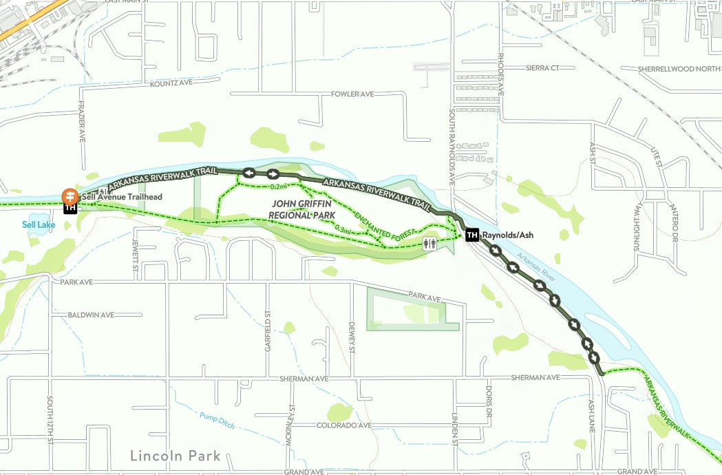
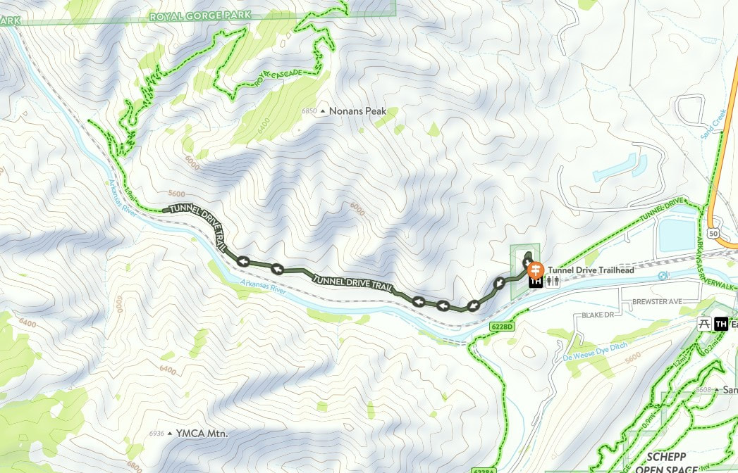
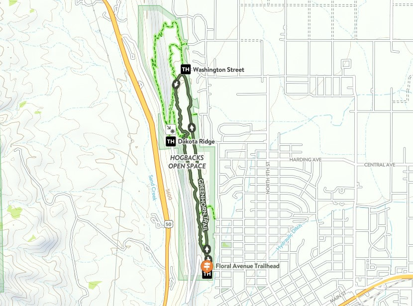
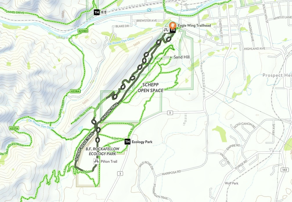
Signage and Trail Tools: 
All of our signs and tools are purchased with 1% for Trails funding, which is garnered from local businesses or specified donations. We design all of our signs (minus trail signs, which are created by local business Handeland Signs) in-house to cut cots and ensure consistency. 

We welcome any questions you have about our funding stream or membership. Thank you for your support, your help, your volunteer hours, and your constant commitment to outdoor recreation in Fremont County!

Picture
0 Comments

Stone Quarry / AKA "Batatat"

2/19/2024

0 Comments

 
Picture
In 1905, the Cañon City Daily Record reported that a "much talked-of pleasure driveway along the top of the hogback is rapidly becoming a reality" (Daily Record, October 12, 1905). Thus began the Hogback's official journey toward rewarding recreational drivers, hikers, and mountain bikers with stunning views of the valley. These days, visitors to Skyline Drive and the Hogbacks can enjoy a white-knuckled drive over the top Skyline, or challenge themselves to several singletrack adventures on the east-facing side of the geological feature. The addition of a 1-mile extension of Stone Quarry - now open -  facilitates a challenging and scenic loop along the middle of the largest hogback feature. Located parallel to and below Skyline Drive and above Graneros, the black-diamond (difficult) trail features great views, technical features, access to the historic quarry, and the ability to connect to other trails. 

In the 1800's, the hogbacks was a hotbed of activity - from mining to quarries. Rock mined from the Hogbacks was used to build the Territorial Prison, located downhill from the site on Highway 50. 

Many may have already hiked the Stone Quarry trail, which has an access point along Old Skyline Drive. Last summer's storms damaged a portion of the 100-year-old retaining wall near the trail's start, but this was repaired by the City. Access remains from Old Skyline Drive (about halfway up from the Washington Street trailhead), but the trail now continues from the site of the quarry to a juncture with Greenhorn near the Floral Avenue Trailhead. 
Thanks to a mine shaft closure grant (from state mine royalty funding) initiated by FAR in 2020, the trail was completed in early February by trailbuilders Steve Thomas and Fremont Mitigation & Services (Kirk Anderson and Kerry Meier with assistance by local High School MTB Team rider Sage Currado). 

About halfway along the trail, users will note a large steel grate - indicating a recently closed mine. Thanks to efforts by the Colorado Division of Reclamation, Mining, and Safety, the site is now sealed, but remains open to residents of the hillside - bats. (You're welcome to call the trail by it's unofficial nickname, a portmanteau of 'bat' and 'habitat' - "Batatat".) Please do NOT disturb the grate, as bats are an important part of our local ecology, assisting in pest control, pollinating plants, and dispersing seeds (U.S. Fish and Wildlife Service). 
Picture
Workers at the Harding Sandstone Quarry, just north of the Hogbacks, in 1890. Photo Courtesy of the U.S. Geological Society.  

Stone Quarry is part of the Eastern Fremont Trails Trails and Open Space Master Plan, which stipulates the need for a looped trail throughout the Hogbacks. The trail system is integrated into the Royal Loop plan, which FAR has continually been working toward and creates access via singletrack from town to the Royal Gorge Park and back. FAR was part of the master plan process in 2012. This project was funded by FAR's 1% for Trails Community Initiative and was supported by the City of Cañon City, which provided additional construction funding, staff, and equipment. FAR is dedicated to the maintenance of the trail, in addition to other trails in the Hogbacks system. 

Trail Beta


Trail Name: Stone Quarry
Distance: 1.1 miles
Level: Difficult (Black Diamond)
Surface: Natural Surface Singletrack
Map: Available on Trailforks (will be available on others, including Cotrex, soon)
Features: Some technical points, steep switchback, closed mine shaft (do not throw rocks, please be kind to bat habitat)
Picture
More information about Stone Quarry trail can be found on Trailforks.
Picture
A recently closed mine is visible from the Stone Quarry Trail (aka Batatat) overlooking the City of Cañon City. The mine was officially closed by the Colorado Division of Reclamation, Mining, and Safety. 
0 Comments

Fall / Winter / spring Trail Use

10/31/2023

0 Comments

 
Picture
Ah, winter in the Banana Belt. You can ski at Monarch in the morning and be home in time to head out on trails for a nice mountain bike ride in the evening. But winter weather can make choosing which trail to head out on a little trickier.

Why can't I ride when trails are wet?
In places where leaves, pine needles, and other plants cover the ground in the fall (the Pacific Northwest, Midwest, etc.), it creates a barrier between boots and dirt, allowing trail users to head out on trails in virtually any weather without damaging trails. In the desert, there is no such barrier. When it rains or snows, soils like bentonite stick like peanut butter to tires, feet, paws, and hooves. Some areas also absorb moisture and hold it in so that any use makes deep divots that remain long after the mud has dried. (Those, in turn, hold even more moisture and can get worse as time goes by, similar to a pothole.) 

What CAN I ride or run on? 
Not all trails are created equal. Natural surface trails (with no added gravel or rock) will likely take longer to dry out, especially if they're on north-facing slopes that don't see much sun in the winter. But trails that have been graded, widened, and have added gravel will dry out faster or be available sooner. Luckily, we have plenty of both kinds!

What if it's 99% good to go with just a few mud puddles? 
If you see a random puddle on an otherwise dry trail, go right through it. Riding or walking around it will create trail widening, and we try to "keep singletrack single" to help lessen the impact of trails on natural habitats and ecology. 

Am I just out of luck after it's snowed or rained in the winter? 
Nope! There are a few options in town that will dry out pretty quickly, and those are the crusher-fine (gravel) trails. Also, if the ground is frozen, you can ride pretty much anything, although you WILL have to be careful of any underlying ice. As precipitation begins to melt, however, natural surface trails will likely need some time to dry out. 

So when there's been snow or rain in the fall / winter / spring, where can you ride? Here are your best bets: 

Crusher-Fine / Gravel Trails: 

Riverwalk
Cotrex Link: trails.colorado.gov/trails/arkansas-riverwalk-6224

Tunnel Drive
Cotrex Link: trails.colorado.gov/trails/tunnel-drive-7026

Greenhorn (Hogbacks)
COTrex Link: trails.colorado.gov/trails/greenhorn-6547

Great Gravel Roads:

Temple Canyon Road
Shelf Road
Phantom Canyon Road

Next to dry out: 

Ecology Park / South Cañon 
COTrex Link: trails.colorado.gov/trailheads/ecology-park-361

Oil Well Flats
COTrex Link: trails.colorado.gov/trailheads/oil-well-flats-2632

Royal Gorge Trails
COTrex Link: trails.colorado.gov/trailheads/canyon-rim-371
Picture
Riding on snow will not damage trails as long as the ground is still frozen. As soon as it turns to mud, however, leaving deep tire tracks, footprints, or hoof prints will create damage that will harden and remain for a long time (called "legacy damage" in trail talk.) 
0 Comments

Autumn in the Royal Gorge REgion

10/19/2023

0 Comments

 
The high country often takes center stage in Colorado in the fall, and with just reasons:  aspens across the state begin turning gold and orange in September and put on a dazzling display for a few weeks. 

But as the leaves fall on the summits of some of our favorite high-elevation locations, color slowly creeps into the valleys and plains of our beautiful state. Colorful ash trees, cottonwoods, and maples in the Banana Belt are turning bright shades of gold and green. Catch them on local hikes, along the river, or downtown on Main Street in Cañon City. 

Here are some of our favorite ways to get outside and enjoy the Royal Gorge region's ever-changing foliage: 

Riverwalk - Mackenzie to Reynolds Hill
Distance: 3 miles out-and-back
Elevation change: 
Trailhead: Mackenzie Trailhead
Route: https://trails.colorado.gov/routes/115652
Good for: trail running, walking, biking (slowly, as there are lots of pedestrians)

This smaller parking lot on Mackenzie Avenue (between Florence and Cañon) offers a nice, flat walk along the Arkansas traveling west - except for the hill at the end which offers beautiful views of the river, Fremont Peak, and even Pikes Peak in the distance. There are several spots where the trees create a canopy for full "spooky woods" vibes. Bring binoculars in case you spot a heron or some other birds along the way. 

Picture

Pathfinder Park
Distance: ~1 mile
Elevation change: negligible​
​Trailhead: Parking lot at Pathfinder Park
Good for: walking, trail running

Pathfinder's trails wind through wooded areas both along the river and also around the fishing pond. A wide, crusher-fine trail stretches from the pond to the east end of the park, and more rugged trails wind next to the river and in the trees. Be aware that this area is thick with growth, so be careful with pets (keep them on a leash) as there may be small animals and snakes present. The canopy is beautiful this time of year and there are views of a nearby butte (watch for peregrines!) are pretty stunning. 
​
Picture

 The Temple at Temple Canyon Park
Distance:  1.6 miles
Elevation change: 406 feet
​Trailhead: The Temple Trailhead
Route: https://trails.colorado.gov/routes/115650 
Good for: walking, hiking

From Temple Canyon Road, park high above Grape Creek and hike downward via the trail. You'll encounter plenty of steep switchbacks, so bring hiking poles and good shoes. Cross the creek under the canopy of cottonwood trees and head towards the Temple. Be wary of critters (including snakes) and be sure to bring snacks and water. Enjoy the solitude of the canyon and the quiet ripple of the creek this time of year. 
​

Grape Creek via Ecology Park
Distance: 1.6 miles
Elevation Change: 171 feet
Trailhead: Ecology Park Trailhead
Route: ​https://trails.colorado.gov/routes/115651
Good for: walking, running, kids

​This wide trail is great for kids (mind them on the big hill at the start) and easy to follow. Just follow the Grape Creek trail, then water gap as you work your way downward through the dry creekbed (it only flows after big storms) toward Grape Creek. The creek flows year-round but is low and slow in autumn, offering a great time to look for frogs, play in the water, and explore. 


Grape Creek via Watchtower and Wrath of Grapes
Distance: ~10 miles
Elevation Change: 1,300 feet 
Trailhead: Great Escape Trailhead
Route: From the Great Escape Trailhead (accessible off Temple Canyon Rd.), take Watchtower east or west. You'll encounter Wrath of Grapes as it intercepts Watchtower. Take the trail down to the creek, then turn around to backtrack or ride out to the road and ride the road back to the trailhead. 
​Good for: trail running, mountain biking, hiking
Picture

Centennial Park to Mackenzie Takeout - River Float
Distance: 2.5 Centennial-Reynolds, 4.6 miles Centennial-Mackenzie
Put-In: Centennial park 
Take-Out: Reynolds Ave. or Mackenzie Ave. takeouts
Good for: small human-powered watercraft

If you have a small craft (SUP, duckie, etc.) and have some river experience, this class I-II stretch of river offers some of the most beautiful scenery in the region. Great for fishing along the way or just enjoying the view, this stretch of river is beautiful in the fall. Be courteous to other river users, including anglers, and be sure to ALWAYS wear a PFD or life jacket. And thank Royal Gorge RIO - our sister organization on the river - for all of the great features and safe passages along the way!​
​
Picture

Remember to always to plan ahead and prepare!

Image courtesy of the Colorado Search and Rescue Association (CSAR). Remember to bring everything you'll need to navigate your adventure, fuel your body, protect you from the elements, and self-rescue if necessary. 


Be safe, have fun, and we'll see you on the trails!
Picture
0 Comments

Determining the value of our trails

5/18/2023

1 Comment

 
As recreation users, we value our trails and open spaces in Fremont County. Most of us also know that trails - the planning, construction, signage, and maintenance - cost money. Our community has invested in trails for the last decade, and that investment has yielded some of the region's most beloved trails, including the Riverwalk, Tunnel Drive, and the Hogbacks Open Space.

Investment in Purpose-Build Singletrack
More recently, our community and land managers have also begun to fund singletrack, purpose-built trail systems like South Cañon, Oil Well Flats, and the Royal Gorge Trails. Since the inception of our '1% for Trails' FAR has contributed over $XXX to the construction and maintenance of singletrack trails. Land managers (including the Recreation District, BLM, and the City of Cañon City) have also invested in these amenities, realizing that residents value outdoor recreation experiences and visitors can contribute to the economic vitality of our region. Trails are valuable! But economically, we don't know much of the financial return on our investment, and in order to guide future decisions (plus learn baseline-data about trail-related expenditures), we're working to undergo a socio-economic impact study of public trail systems in Fremont County. 

Creating a Socio-Economic Impact Report with CU
At CU Boulder, the Masters of the Environment program has a Capstone requirement. The Capstone program is a competitive process that pairs students with businesses and organization that have a need - whether for a product or a process. In January, FAR submitted an application for a project and was selected by a team of students. We are overjoyed to be working with Masters candidates Joshua Corning, Eric Howard, and Nathan Boyer-Rechlin. They've already done a tremendous amount of work researching the process and similar reports (you can see similar reports for the Grand Valley here). 


We need YOUR help collecting data! 

A report of this kind requires a significant amount of data collection. The team will solicit information via an online survey to all residents of the community, but also in-person surveys to those who are actually ON trails. This portion of the data collection requires volunteer assistance. Helping is easy! Just hang out at a trailhead for a few hours before or after a ride or hike, chat with trail users, and enjoy being outside. 

The first step in becoming a volunteer is to attend the volunteer training. This quick, one-hour class will introduce you to the project, help you understand the survey and methodology, and give you the tools you need to be successful. ​

Volunteers will be required to staff at least two 2-hour sessions throughout the summer. Data collection is done through a 'trail intercept' survey, which means that you'll be stationed a popular trailshead, will chat with trail users as they start out on their excursion, and ask them to take a brief (3-minute) survey about their experience in our region. Whether they're local or visitors, we'd love to hear from them! 

Training date: TBD (very soon!)

Picture
Master's candidates Nathan Boyer-Rechlin, Eric Howard, and Joshua Corning visit the Royal Gorge Trails in an introductory meeting about the region. (This photo wasn't taken NEARLY as close to the edge as it looks in this photo.) 
Picture
1 Comment

Top 5 3-Mile trail running routes

3/27/2023

0 Comments

 
Whether you're training for a race (like the runBlossom 5K on May 6th) or just looking for a great loop to hike, bike, or run, we've put together a few of our favorite 3-mile loops in the area. From flat to heart-pumping hilly, these courses will offer great terrain and gorgeous views. 
Picture
Shown above: View from the Riverwalk Trail at the top of Reynolds Hill. 

Riverwalk Central 

Picture
Start at the Sells Avenue Trailhead of the Riverwalk (just past the surgery center), and start out with a nice, easy flat run. You'll pass the ropes course, the pond, and duck under the Reynolds Bridge. For a grand finale, head up Reynolds Hill! You'll catch amazing views of Pikes Peak, the Arkansas, and Fremont Peak from the viewpoint and benches at the top of the hill. Head back down for a smooth run back to the trailhead. Take the Bluff Trail to change it up a little bit on the way back!
Rivewalk Central - CoTrex Map

Tunnel Drive

Picture
Tunnel Drive is an historic and scenic route that is easily accessible from town. Just head out on Hwy. 50 and turn L onto Tunnel Drive road. You'll find the trailhead at the end of the road (please observe the posted speed limit as this is a residential area!), and you can start your adventure from the parking lot. Walk up the hill or start your run at the bottom. Tunnel Drive continues for about 2 mile to the end, so turn around before that point if you are shooting for a 3 mile run. After the hill, the trail is wide and flat - enjoy the views of Grape Creek, the Royal Gorge, and (possibly) some wildlife! 
Tunnel Drive - CoTREX Map

Hogbacks

Picture
When you're ready to graduate from flat terrain to some rolling hills, the Hogbacks is a great place to train! Head out from Floral Avenue Trailhead on Greenhorn - a wide, gravel path that heads north. You can return on the same trail, or cut over to Graneros by taking a left onto the Old Skyline trail and another left onto Graneros. It's singletrack, so be aware of cactus and some exposure. There's plenty of up-and-down to keep you busy while getting a great workout and super views!
Hogbacks - CoTREX Map

South Cañon 

Picture
Love a good run that ends on a nice, sustained downhill? You'll love this up-up-down-down route that takes you from Eagle Wing Trailhead, up Mutton Bustin', and through Ecology Park before returning to the trailhead. You'll encounter plenty of other users on this trail system, so be aware of your surroundings, and enjoy the beautiful views along Schepp Ridge, among others! This route is about 3.4 miles. 
South CaƱon - CoTREX Map

Royal Gorge

Picture
Ready for a challenge? Made in the Shade is a great 3.1-mile loop at the Royal Gorge Trails system. You can run either direction (clockwise or counter-clockwise), but be sure to stop and enjoy the views. You'll encounter some great downhill and reciprocating uphill, so be ready for a heart-pumping run. There is some exposure (dropoffs) on this trail, so be careful - especially if on your bicycle. This is a true loop and ends where it starts - a great route! 
Made in the Shade - CoTREX Map
0 Comments
<<Previous

    FAR

    FAR is committed to encouraging outdoor recreation in the Royal Gorge Region. 

    Archives

    February 2025
    December 2024
    October 2024
    April 2024
    February 2024
    October 2023
    May 2023
    March 2023
    December 2022
    November 2022
    October 2022
    March 2022
    September 2021
    August 2021
    May 2021
    April 2021
    March 2021
    January 2021
    November 2020
    October 2020
    April 2020
    October 2019
    September 2019
    June 2019
    May 2019
    October 2018
    October 2016
    July 2016

    Categories

    All

    RSS Feed

Powered by Create your own unique website with customizable templates.