
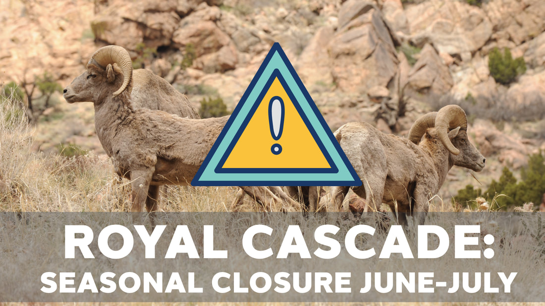
What's up with the seasonal closure?
Royal Cascade runs through bighorn sheep habitat. In June and July, the trail will be completely CLOSED to all recreational uses. This is to allow sheep to have lambs. When sheep are threatened or scared, they run. When they run, they burn calories (as runners and bikers, we know this!). If sheep expend calories running from trail users, they have fewer calories to pass on to their lambs, and that's not healthy.
In September and October, the trail is open only from 9:00 am -5:00 pm. This is to allow hunting of bighorn sheep for those who "pull a tag" (aka, are allowed through a lottery system to hunt for a sheep) to hunt safely. Hunters and anglers pay a fee for this use and contribute to funds used for conservation of public lands. Please respect ALL CLOSURES.
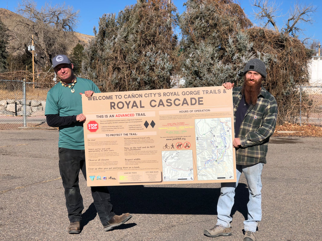
Who built this trail?
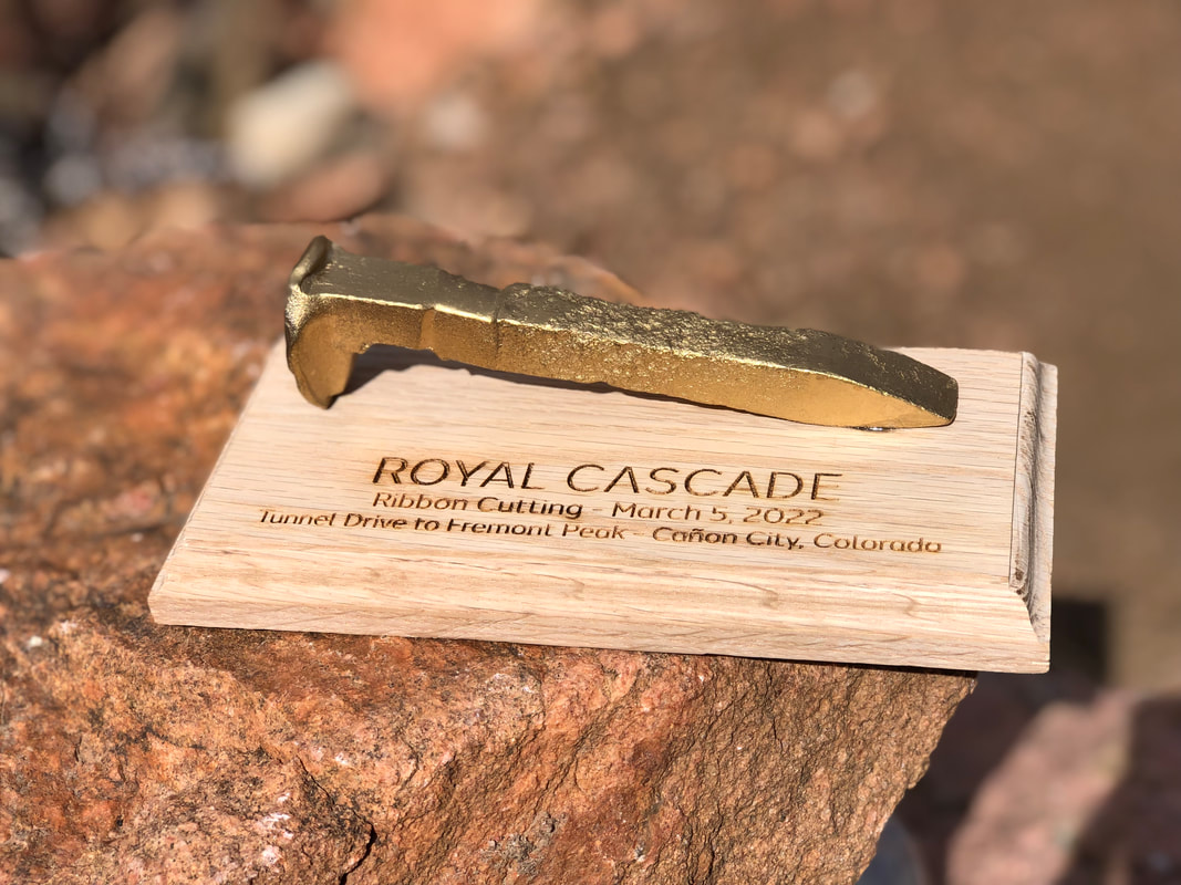
Royal Cascade was funded by the City of Cañon City. First identified as a potential route over 25 years ago, it is part of the Eastern Fremont County Trails Master Plan. The City funded the trail and contracted Steve Thomas of Terra Firma Trails to build it. FAR provided some assistance though funding and equipment needs.
Royal Cascade runs through bighorn sheep habitat. In June and July, the trail will be completely CLOSED to all recreational uses. This is to allow sheep to have lambs. When sheep are threatened or scared, they run. When they run, they burn calories (as runners and bikers, we know this!). If sheep expend calories running from trail users, they have fewer calories to pass on to their lambs, and that's not healthy.
In September and October, the trail is open only from 9:00 am -5:00 pm. This is to allow hunting of bighorn sheep for those who "pull a tag" (aka, are allowed through a lottery system to hunt for a sheep) to hunt safely. Hunters and anglers pay a fee for this use and contribute to funds used for conservation of public lands. Please respect ALL CLOSURES.
Who built this trail?
Royal Cascade was funded by the City of Cañon City. First identified as a potential route over 25 years ago, it is part of the Eastern Fremont County Trails Master Plan. The City funded the trail and contracted Steve Thomas of Terra Firma Trails to build it. FAR provided some assistance though funding and equipment needs.
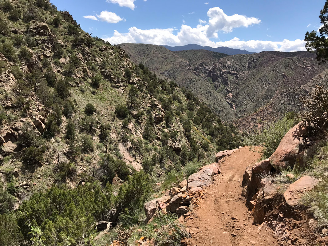
Is this trail difficult?
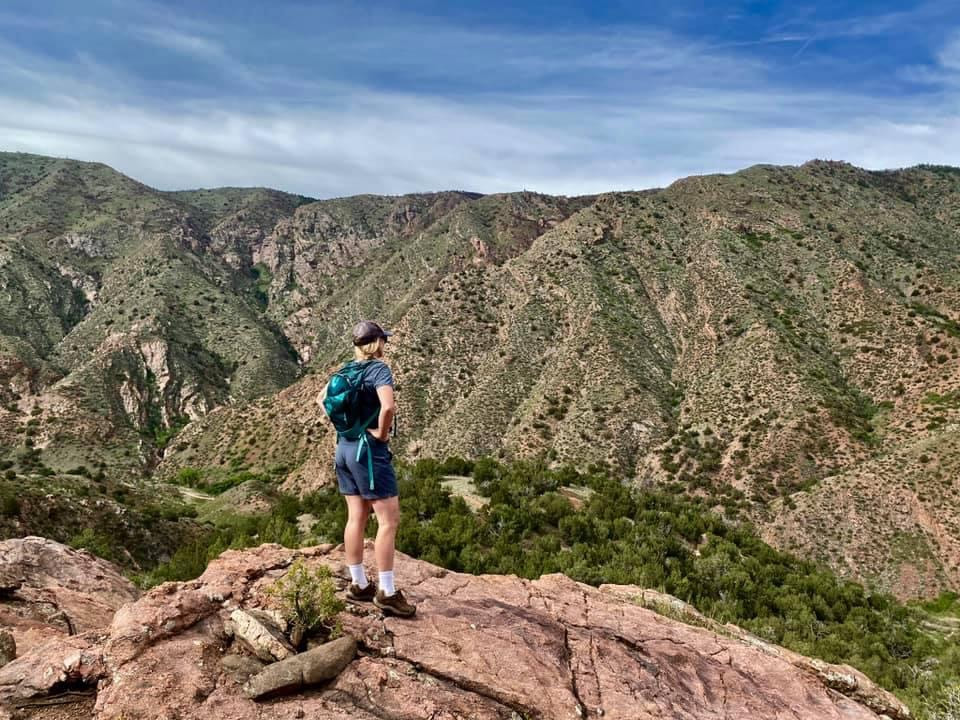
YES. This trail is open to hikers, walkers, bikers, and runners. How you access this trail and what your fitness level is will determine how hard it is. Be aware that 1,800 fee of elevation gain is a LOT. For those who are training for intense races, love a challenge, or can handle that kind of elevation gain on their feet / bike, it's a great climb. For other (mere mortals), Royal Cascade may be best used in a downhill direction (as long as you are a competent rider - this is NOT for beginners either direction.) For most mountain bikers, using the trail as a connection from the Royal Gorge Trails to Tunnel Drive (with a shuttle so you don't have to climb back up) is a great idea.
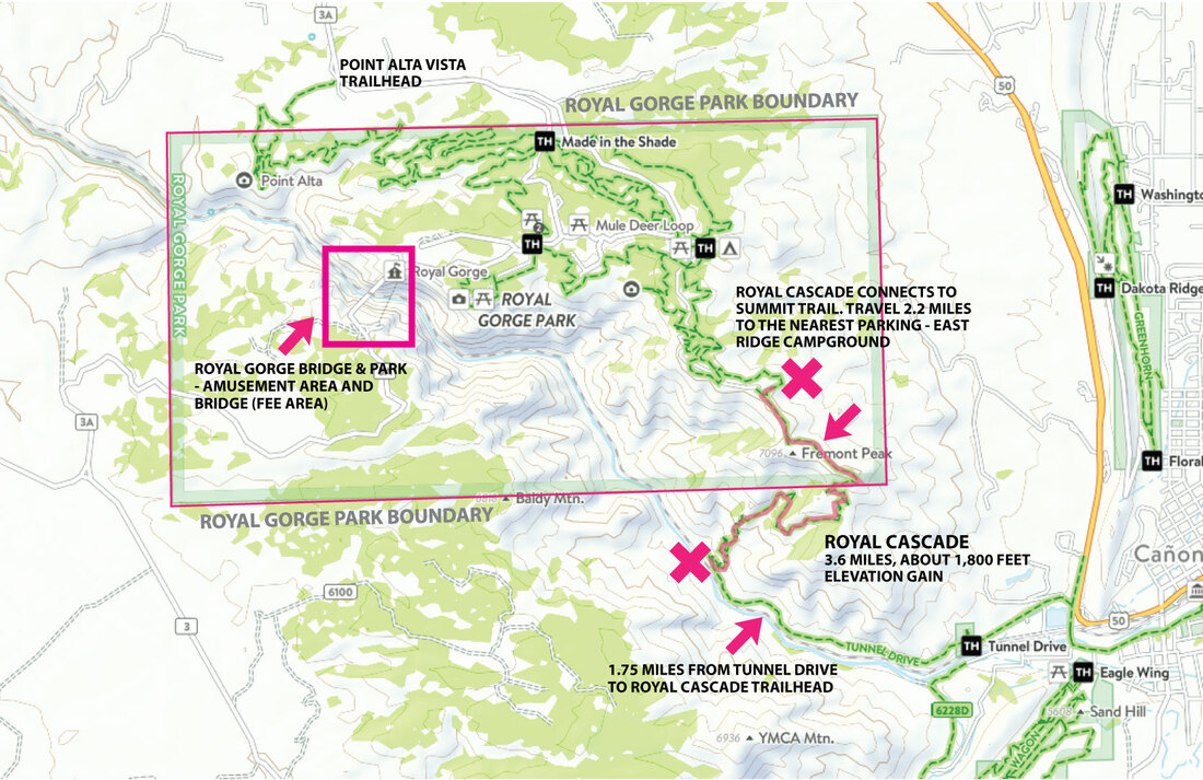
Does the trail reach the Royal Gorge Bridge?
No. This trail ONLY reaches the Royal Gorge Park, which is the 5,000-acre City Park that also contains 22 miles of singletrack trail. You cannot reach the bridge from any of the Royal Gorge Park Trails.
YES. This trail is open to hikers, walkers, bikers, and runners. How you access this trail and what your fitness level is will determine how hard it is. Be aware that 1,800 fee of elevation gain is a LOT. For those who are training for intense races, love a challenge, or can handle that kind of elevation gain on their feet / bike, it's a great climb. For other (mere mortals), Royal Cascade may be best used in a downhill direction (as long as you are a competent rider - this is NOT for beginners either direction.) For most mountain bikers, using the trail as a connection from the Royal Gorge Trails to Tunnel Drive (with a shuttle so you don't have to climb back up) is a great idea.
Does the trail reach the Royal Gorge Bridge?
No. This trail ONLY reaches the Royal Gorge Park, which is the 5,000-acre City Park that also contains 22 miles of singletrack trail. You cannot reach the bridge from any of the Royal Gorge Park Trails.
Do we have to pay to use it?
No. The City's Royal Gorge Park is a large parcel of land that has been owned by the City since 1906. The park spans both sides of the Arkansas River and the Royal Gorge, but trails only exist on the north side. They are accessible via four trialheads / parking areas. There are over 22 miles of singletrack trail located within the park, along with a campground (East Ridge), a scenic overlook (Overlook Loop), and a day use area (Canyon Rim Trailhead). All of these amenities are FREE to the public. The Royal Gorge Bridge & Park is a smaller parcel (about 360 acres) leased to a company who runs the admission to the Bridge, the gondola, playland, etc. Admission fees apply only to the amusement area and bridge, NOT trails. (The Royal Gorge Bridge & Park is a 1% for Trails contributor, and your purchase in the gift shop helps fund trails in the area, however!)
Where are the trailheads to Royal Cascade?
Royal Cascade doesn't have it's own parking areas / trailheads. To access the trail, you'll have to travel on other trails. You can park at the Tunnel Drive trailhead, located at the end of Tunnel Drive, and travel 1.75 miles to the start of the trail, then climb up. Or, you can park at the East Ridge Campground, travel on FAR Out and Summit Trail, then travel down Royal Cascade.
What's the total distance?
The trail itself is only 3.6 miles and-to-end, but you have to travel on other trails to get to it. So, even an out-and-back on Tunnel Drive + Royal Cascade will equal about 10 miles. PLEASE remember that this is a very difficult trail with no access to help, no water, and very little shade. If you attempt this trail, you should carry the 10 essentials, tell someone where you'll be, and assess your ability and fitness level.
Can I get a map?
You bet! We highly recommend that you use CoTREX (free to use and download) to help you navigate trails. You can download them, track your progress, and make sure that you're in the right area. You can also pick up a FREE FAR Adventure Guide starting on April 15th.
 RSS Feed
