
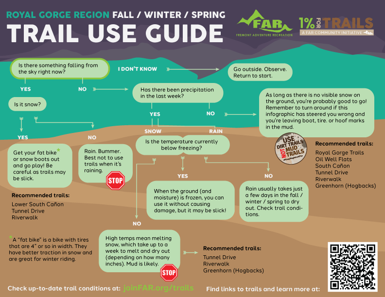
Ah, winter in the Banana Belt. You can ski at Monarch in the morning and be home in time to head out on trails for a nice mountain bike ride in the evening. But winter weather can make choosing which trail to head out on a little trickier.
Why can't I ride when trails are wet?
In places where leaves, pine needles, and other plants cover the ground in the fall (the Pacific Northwest, Midwest, etc.), it creates a barrier between boots and dirt, allowing trail users to head out on trails in virtually any weather without damaging trails. In the desert, there is no such barrier. When it rains or snows, soils like bentonite stick like peanut butter to tires, feet, paws, and hooves. Some areas also absorb moisture and hold it in so that any use makes deep divots that remain long after the mud has dried. (Those, in turn, hold even more moisture and can get worse as time goes by, similar to a pothole.)
What CAN I ride or run on?
Not all trails are created equal. Natural surface trails (with no added gravel or rock) will likely take longer to dry out, especially if they're on north-facing slopes that don't see much sun in the winter. But trails that have been graded, widened, and have added gravel will dry out faster or be available sooner. Luckily, we have plenty of both kinds!
What if it's 99% good to go with just a few mud puddles?
If you see a random puddle on an otherwise dry trail, go right through it. Riding or walking around it will create trail widening, and we try to "keep singletrack single" to help lessen the impact of trails on natural habitats and ecology.
Am I just out of luck after it's snowed or rained in the winter?
Nope! There are a few options in town that will dry out pretty quickly, and those are the crusher-fine (gravel) trails. Also, if the ground is frozen, you can ride pretty much anything, although you WILL have to be careful of any underlying ice. As precipitation begins to melt, however, natural surface trails will likely need some time to dry out.
So when there's been snow or rain in the fall / winter / spring, where can you ride? Here are your best bets:
Crusher-Fine / Gravel Trails:
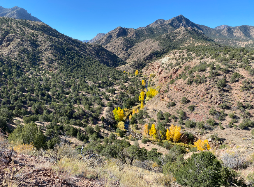
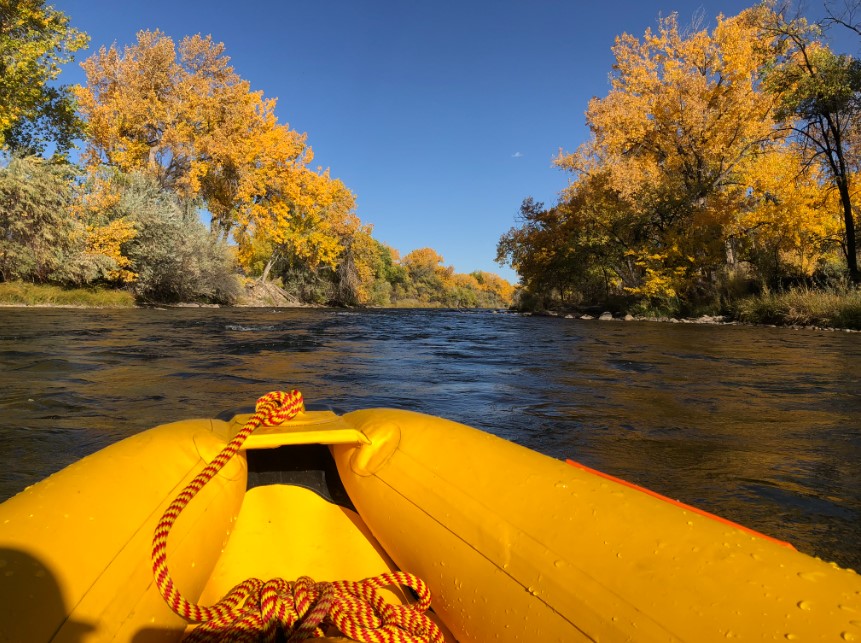
Riverwalk
Cotrex Link: trails.colorado.gov/trails/arkansas-riverwalk-6224
Tunnel Drive
Cotrex Link: trails.colorado.gov/trails/tunnel-drive-7026
Greenhorn (Hogbacks)
COTrex Link: trails.colorado.gov/trails/greenhorn-6547
Great Gravel Roads:
Temple Canyon Road
Shelf Road
Phantom Canyon Road
Next to dry out:
Ecology Park / South Cañon
COTrex Link: trails.colorado.gov/trailheads/ecology-park-361
Oil Well Flats
COTrex Link: trails.colorado.gov/trailheads/oil-well-flats-2632
Royal Gorge Trails
COTrex Link: trails.colorado.gov/trailheads/canyon-rim-371
Why can't I ride when trails are wet?
In places where leaves, pine needles, and other plants cover the ground in the fall (the Pacific Northwest, Midwest, etc.), it creates a barrier between boots and dirt, allowing trail users to head out on trails in virtually any weather without damaging trails. In the desert, there is no such barrier. When it rains or snows, soils like bentonite stick like peanut butter to tires, feet, paws, and hooves. Some areas also absorb moisture and hold it in so that any use makes deep divots that remain long after the mud has dried. (Those, in turn, hold even more moisture and can get worse as time goes by, similar to a pothole.)
What CAN I ride or run on?
Not all trails are created equal. Natural surface trails (with no added gravel or rock) will likely take longer to dry out, especially if they're on north-facing slopes that don't see much sun in the winter. But trails that have been graded, widened, and have added gravel will dry out faster or be available sooner. Luckily, we have plenty of both kinds!
What if it's 99% good to go with just a few mud puddles?
If you see a random puddle on an otherwise dry trail, go right through it. Riding or walking around it will create trail widening, and we try to "keep singletrack single" to help lessen the impact of trails on natural habitats and ecology.
Am I just out of luck after it's snowed or rained in the winter?
Nope! There are a few options in town that will dry out pretty quickly, and those are the crusher-fine (gravel) trails. Also, if the ground is frozen, you can ride pretty much anything, although you WILL have to be careful of any underlying ice. As precipitation begins to melt, however, natural surface trails will likely need some time to dry out.
So when there's been snow or rain in the fall / winter / spring, where can you ride? Here are your best bets:
Crusher-Fine / Gravel Trails:
Riverwalk
Cotrex Link: trails.colorado.gov/trails/arkansas-riverwalk-6224
Tunnel Drive
Cotrex Link: trails.colorado.gov/trails/tunnel-drive-7026
Greenhorn (Hogbacks)
COTrex Link: trails.colorado.gov/trails/greenhorn-6547
Great Gravel Roads:
Temple Canyon Road
Shelf Road
Phantom Canyon Road
Next to dry out:
Ecology Park / South Cañon
COTrex Link: trails.colorado.gov/trailheads/ecology-park-361
Oil Well Flats
COTrex Link: trails.colorado.gov/trailheads/oil-well-flats-2632
Royal Gorge Trails
COTrex Link: trails.colorado.gov/trailheads/canyon-rim-371
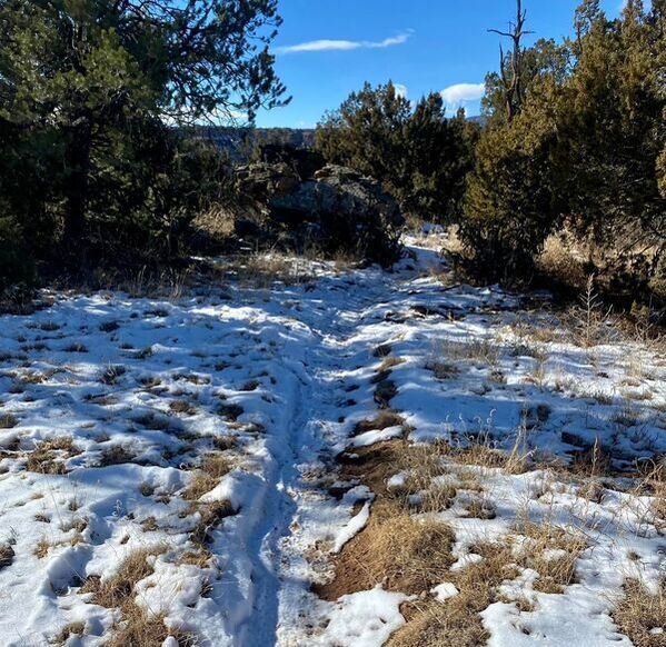
Riding on snow will not damage trails as long as the ground is still frozen. As soon as it turns to mud, however, leaving deep tire tracks, footprints, or hoof prints will create damage that will harden and remain for a long time (called "legacy damage" in trail talk.)
 RSS Feed
