
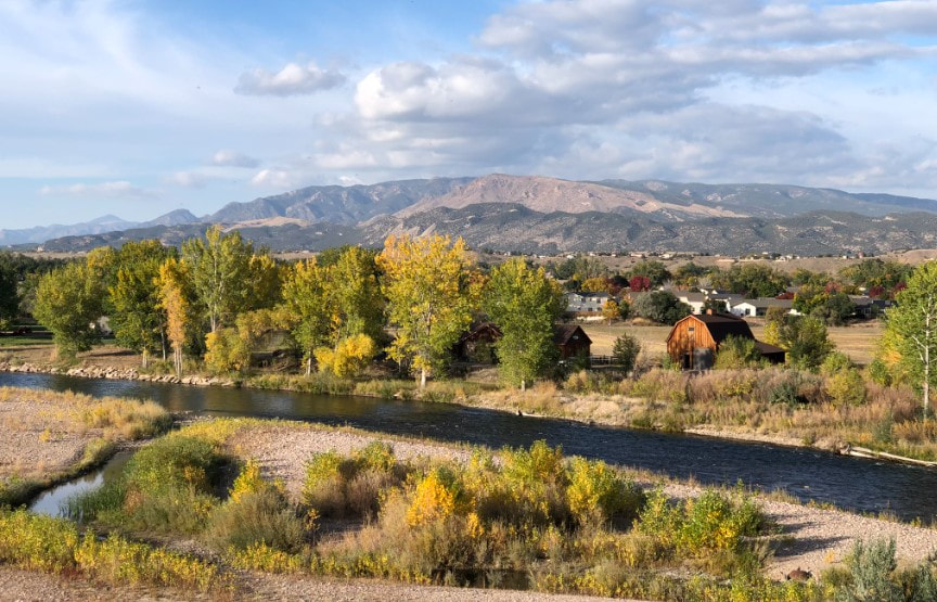
The high country often takes center stage in Colorado in the fall, and with just reasons: aspens across the state begin turning gold and orange in September and put on a dazzling display for a few weeks.
But as the leaves fall on the summits of some of our favorite high-elevation locations, color slowly creeps into the valleys and plains of our beautiful state. Colorful ash trees, cottonwoods, and maples in the Banana Belt are turning bright shades of gold and green. Catch them on local hikes, along the river, or downtown on Main Street in Cañon City.
Here are some of our favorite ways to get outside and enjoy the Royal Gorge region's ever-changing foliage:
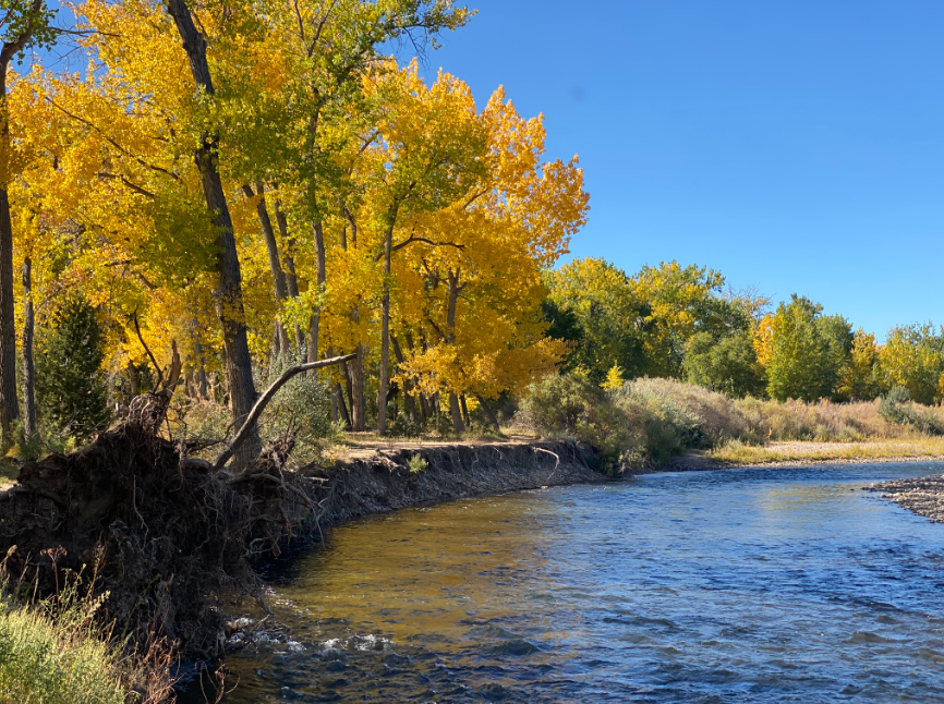
Riverwalk - Mackenzie to Reynolds Hill
Distance: 3 miles out-and-back
Elevation change:
Trailhead: Mackenzie Trailhead
Route: https://trails.colorado.gov/routes/115652
Good for: trail running, walking, biking (slowly, as there are lots of pedestrians)
This smaller parking lot on Mackenzie Avenue (between Florence and Cañon) offers a nice, flat walk along the Arkansas traveling west - except for the hill at the end which offers beautiful views of the river, Fremont Peak, and even Pikes Peak in the distance. There are several spots where the trees create a canopy for full "spooky woods" vibes. Bring binoculars in case you spot a heron or some other birds along the way.
Pathfinder Park
Distance: ~1 mile
Elevation change: negligible
Trailhead: Parking lot at Pathfinder Park
Good for: walking, trail running
Pathfinder's trails wind through wooded areas both along the river and also around the fishing pond. A wide, crusher-fine trail stretches from the pond to the east end of the park, and more rugged trails wind next to the river and in the trees. Be aware that this area is thick with growth, so be careful with pets (keep them on a leash) as there may be small animals and snakes present. The canopy is beautiful this time of year and there are views of a nearby butte (watch for peregrines!) are pretty stunning.
The Temple at Temple Canyon Park
Distance: 1.6 miles
Elevation change: 406 feet
Trailhead: The Temple Trailhead
Route: https://trails.colorado.gov/routes/115650
Good for: walking, hiking
From Temple Canyon Road, park high above Grape Creek and hike downward via the trail. You'll encounter plenty of steep switchbacks, so bring hiking poles and good shoes. Cross the creek under the canopy of cottonwood trees and head towards the Temple. Be wary of critters (including snakes) and be sure to bring snacks and water. Enjoy the solitude of the canyon and the quiet ripple of the creek this time of year.
Grape Creek via Ecology Park
Distance: 1.6 miles
Elevation Change: 171 feet
Trailhead: Ecology Park Trailhead
Route: https://trails.colorado.gov/routes/115651
Good for: walking, running, kids
This wide trail is great for kids (mind them on the big hill at the start) and easy to follow. Just follow the Grape Creek trail, then water gap as you work your way downward through the dry creekbed (it only flows after big storms) toward Grape Creek. The creek flows year-round but is low and slow in autumn, offering a great time to look for frogs, play in the water, and explore.
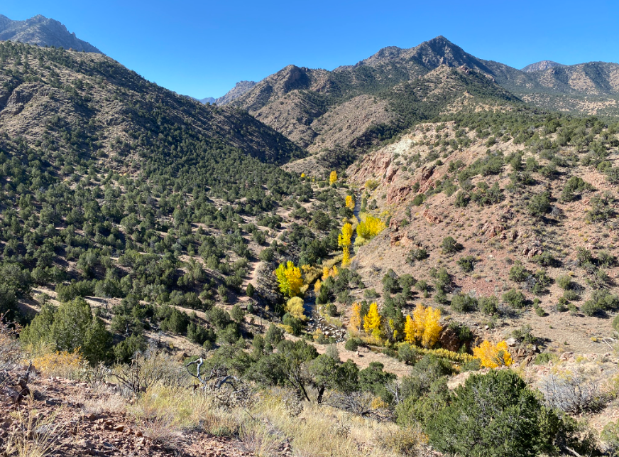
Grape Creek via Watchtower and Wrath of Grapes
Distance: ~10 miles
Elevation Change: 1,300 feet
Trailhead: Great Escape Trailhead
Route: From the Great Escape Trailhead (accessible off Temple Canyon Rd.), take Watchtower east or west. You'll encounter Wrath of Grapes as it intercepts Watchtower. Take the trail down to the creek, then turn around to backtrack or ride out to the road and ride the road back to the trailhead.
Good for: trail running, mountain biking, hiking
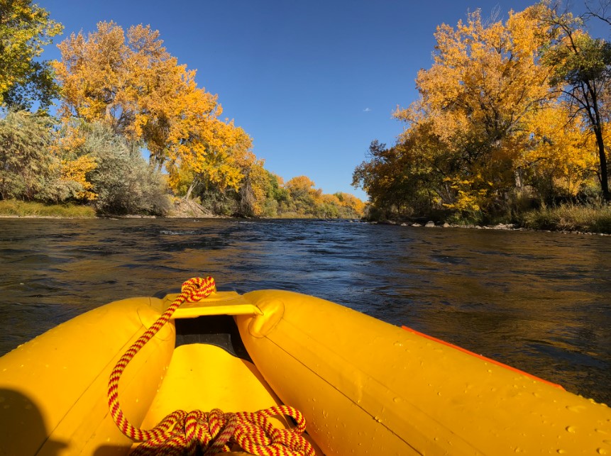
Centennial Park to Mackenzie Takeout - River Float
Distance: 2.5 Centennial-Reynolds, 4.6 miles Centennial-Mackenzie
Put-In: Centennial park
Take-Out: Reynolds Ave. or Mackenzie Ave. takeouts
Good for: small human-powered watercraft
If you have a small craft (SUP, duckie, etc.) and have some river experience, this class I-II stretch of river offers some of the most beautiful scenery in the region. Great for fishing along the way or just enjoying the view, this stretch of river is beautiful in the fall. Be courteous to other river users, including anglers, and be sure to ALWAYS wear a PFD or life jacket. And thank Royal Gorge RIO - our sister organization on the river - for all of the great features and safe passages along the way!
| Remember to always to plan ahead and prepare! Image courtesy of the Colorado Search and Rescue Association (CSAR). Remember to bring everything you'll need to navigate your adventure, fuel your body, protect you from the elements, and self-rescue if necessary. Be safe, have fun, and we'll see you on the trails! | 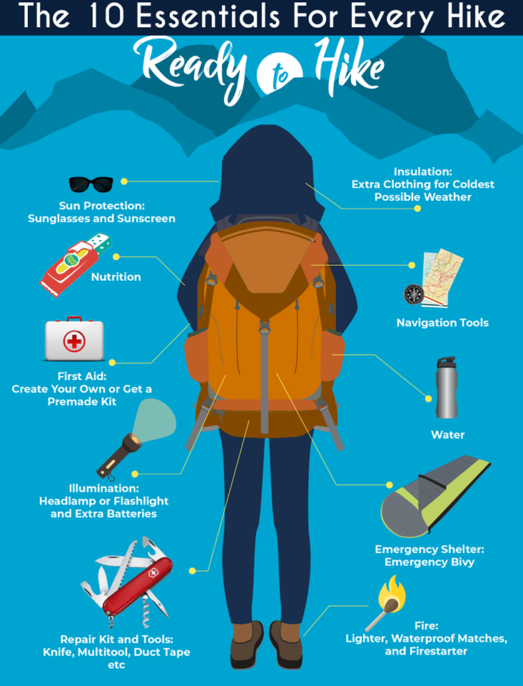 |
 RSS Feed
